You are here: Home > Network List > US - United States National Seismic Network Stations List
> Station TPNV Topopah Spring, Nevada, USA > Earthquake Result Viewer
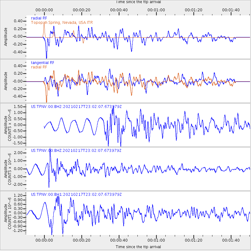
TPNV Topopah Spring, Nevada, USA - Earthquake Result Viewer
*The percent match for this event was below the threshold and hence no stack was calculated.
| Earthquake location: |
Southeast Of Loyalty Islands |
| Earthquake latitude/longitude: |
-23.2/171.8 |
| Earthquake time(UTC): |
2021/02/17 (048) 22:49:38 GMT |
| Earthquake Depth: |
13 km |
| Earthquake Magnitude: |
6.1 Mww |
| Earthquake Catalog/Contributor: |
NEIC PDE/us |
|
| Network: |
US United States National Seismic Network |
| Station: |
TPNV Topopah Spring, Nevada, USA |
| Lat/Lon: |
36.95 N/116.25 W |
| Elevation: |
1600 m |
|
| Distance: |
90.4 deg |
| Az: |
49.63 deg |
| Baz: |
241.058 deg |
| Ray Param: |
$rayparam |
*The percent match for this event was below the threshold and hence was not used in the summary stack. |
|
| Radial Match: |
84.92411 % |
| Radial Bump: |
400 |
| Transverse Match: |
66.61346 % |
| Transverse Bump: |
400 |
| SOD ConfigId: |
23341671 |
| Insert Time: |
2021-03-04 00:07:15.610 +0000 |
| GWidth: |
2.5 |
| Max Bumps: |
400 |
| Tol: |
0.001 |
|
Signal To Noise
| Channel | StoN | STA | LTA |
| US:TPNV:00:BHZ:20210217T23:02:07.673979Z | 2.614854 | 9.577976E-7 | 3.6629106E-7 |
| US:TPNV:00:BH1:20210217T23:02:07.673979Z | 3.7266283 | 6.83166E-7 | 1.8332013E-7 |
| US:TPNV:00:BH2:20210217T23:02:07.673979Z | 1.931904 | 7.018505E-7 | 3.6329473E-7 |
| Arrivals |
| Ps | |
| PpPs | |
| PsPs/PpSs | |


