You are here: Home > Network List > UU - University of Utah Regional Network Stations List
> Station CCUT Cedar City, UT, USA > Earthquake Result Viewer
CCUT Cedar City, UT, USA - Earthquake Result Viewer
*The percent match for this event was below the threshold and hence no stack was calculated.
| Earthquake location: |
Southeast Of Loyalty Islands |
| Earthquake latitude/longitude: |
-23.2/171.8 |
| Earthquake time(UTC): |
2021/02/17 (048) 22:49:38 GMT |
| Earthquake Depth: |
13 km |
| Earthquake Magnitude: |
6.1 Mww |
| Earthquake Catalog/Contributor: |
NEIC PDE/us |
|
| Network: |
UU University of Utah Regional Network |
| Station: |
CCUT Cedar City, UT, USA |
| Lat/Lon: |
37.55 N/113.36 W |
| Elevation: |
2127 m |
|
| Distance: |
92.7 deg |
| Az: |
50.184 deg |
| Baz: |
242.783 deg |
| Ray Param: |
$rayparam |
*The percent match for this event was below the threshold and hence was not used in the summary stack. |
|
| Radial Match: |
71.35197 % |
| Radial Bump: |
301 |
| Transverse Match: |
57.046677 % |
| Transverse Bump: |
400 |
| SOD ConfigId: |
23341671 |
| Insert Time: |
2021-03-04 00:07:22.325 +0000 |
| GWidth: |
2.5 |
| Max Bumps: |
400 |
| Tol: |
0.001 |
|
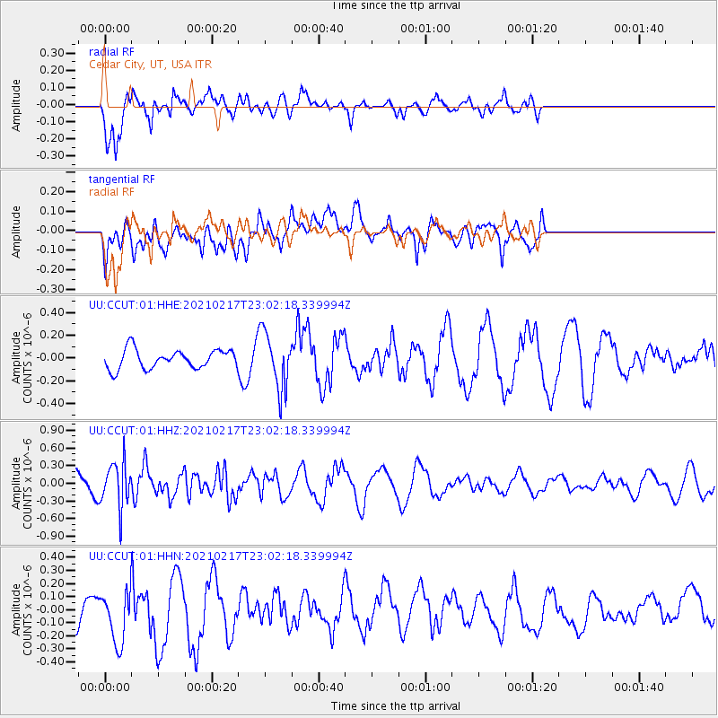
Signal To Noise
| Channel | StoN | STA | LTA |
| UU:CCUT:01:HHZ:20210217T23:02:18.339994Z | 2.169945 | 3.8340008E-7 | 1.7668654E-7 |
| UU:CCUT:01:HHN:20210217T23:02:18.339994Z | 1.7352877 | 2.079899E-7 | 1.1985904E-7 |
| UU:CCUT:01:HHE:20210217T23:02:18.339994Z | 3.0085604 | 2.503455E-7 | 8.321106E-8 |
| Arrivals |
| Ps | |
| PpPs | |
| PsPs/PpSs | |


