You are here: Home > Network List > UU - University of Utah Regional Network Stations List
> Station KNB Kanab, UT, USA > Earthquake Result Viewer
KNB Kanab, UT, USA - Earthquake Result Viewer
*The percent match for this event was below the threshold and hence no stack was calculated.
| Earthquake location: |
Southeast Of Loyalty Islands |
| Earthquake latitude/longitude: |
-23.2/171.8 |
| Earthquake time(UTC): |
2021/02/17 (048) 22:49:38 GMT |
| Earthquake Depth: |
13 km |
| Earthquake Magnitude: |
6.1 Mww |
| Earthquake Catalog/Contributor: |
NEIC PDE/us |
|
| Network: |
UU University of Utah Regional Network |
| Station: |
KNB Kanab, UT, USA |
| Lat/Lon: |
37.02 N/112.82 W |
| Elevation: |
1715 m |
|
| Distance: |
92.8 deg |
| Az: |
50.856 deg |
| Baz: |
243.077 deg |
| Ray Param: |
$rayparam |
*The percent match for this event was below the threshold and hence was not used in the summary stack. |
|
| Radial Match: |
57.103992 % |
| Radial Bump: |
400 |
| Transverse Match: |
52.3194 % |
| Transverse Bump: |
400 |
| SOD ConfigId: |
23341671 |
| Insert Time: |
2021-03-04 00:07:32.379 +0000 |
| GWidth: |
2.5 |
| Max Bumps: |
400 |
| Tol: |
0.001 |
|
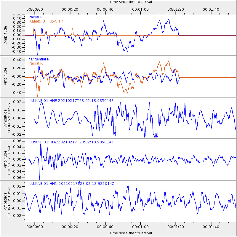
Signal To Noise
| Channel | StoN | STA | LTA |
| UU:KNB:01:HHZ:20210217T23:02:18.985014Z | 4.2001143 | 2.4394426E-8 | 5.808039E-9 |
| UU:KNB:01:HHN:20210217T23:02:18.985014Z | 1.1885448 | 8.166522E-9 | 6.871026E-9 |
| UU:KNB:01:HHE:20210217T23:02:18.985014Z | 1.3259528 | 9.7749995E-9 | 7.3720567E-9 |
| Arrivals |
| Ps | |
| PpPs | |
| PsPs/PpSs | |


