You are here: Home > Network List > UW - Pacific Northwest Regional Seismic Network Stations List
> Station BLOW BLOW, Detroit Lake, OR, USA > Earthquake Result Viewer
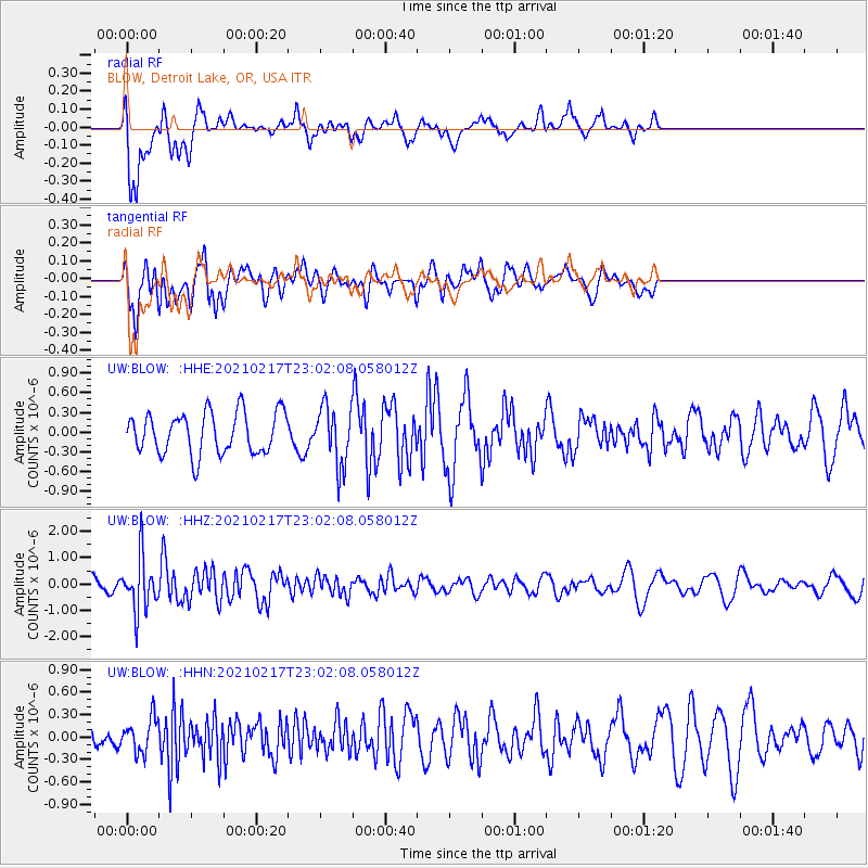
BLOW BLOW, Detroit Lake, OR, USA - Earthquake Result Viewer
*The percent match for this event was below the threshold and hence no stack was calculated.
| Earthquake location: |
Southeast Of Loyalty Islands |
| Earthquake latitude/longitude: |
-23.2/171.8 |
| Earthquake time(UTC): |
2021/02/17 (048) 22:49:38 GMT |
| Earthquake Depth: |
13 km |
| Earthquake Magnitude: |
6.1 Mww |
| Earthquake Catalog/Contributor: |
NEIC PDE/us |
|
| Network: |
UW Pacific Northwest Regional Seismic Network |
| Station: |
BLOW BLOW, Detroit Lake, OR, USA |
| Lat/Lon: |
44.68 N/122.19 W |
| Elevation: |
657 m |
|
| Distance: |
90.5 deg |
| Az: |
40.691 deg |
| Baz: |
237.246 deg |
| Ray Param: |
$rayparam |
*The percent match for this event was below the threshold and hence was not used in the summary stack. |
|
| Radial Match: |
68.328896 % |
| Radial Bump: |
400 |
| Transverse Match: |
65.58822 % |
| Transverse Bump: |
400 |
| SOD ConfigId: |
23341671 |
| Insert Time: |
2021-03-04 00:07:53.734 +0000 |
| GWidth: |
2.5 |
| Max Bumps: |
400 |
| Tol: |
0.001 |
|
Signal To Noise
| Channel | StoN | STA | LTA |
| UW:BLOW: :HHZ:20210217T23:02:08.058012Z | 3.4377387 | 1.0038193E-6 | 2.9199987E-7 |
| UW:BLOW: :HHN:20210217T23:02:08.058012Z | 1.213305 | 2.2518573E-7 | 1.8559696E-7 |
| UW:BLOW: :HHE:20210217T23:02:08.058012Z | 1.3954749 | 4.3543585E-7 | 3.1203416E-7 |
| Arrivals |
| Ps | |
| PpPs | |
| PsPs/PpSs | |


