You are here: Home > Network List > UW - Pacific Northwest Regional Seismic Network Stations List
> Station IZEE Izee, OR, USA > Earthquake Result Viewer
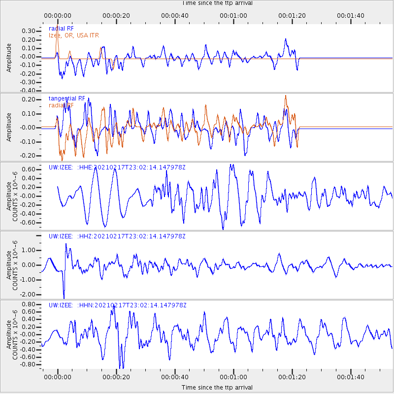
IZEE Izee, OR, USA - Earthquake Result Viewer
*The percent match for this event was below the threshold and hence no stack was calculated.
| Earthquake location: |
Southeast Of Loyalty Islands |
| Earthquake latitude/longitude: |
-23.2/171.8 |
| Earthquake time(UTC): |
2021/02/17 (048) 22:49:38 GMT |
| Earthquake Depth: |
13 km |
| Earthquake Magnitude: |
6.1 Mww |
| Earthquake Catalog/Contributor: |
NEIC PDE/us |
|
| Network: |
UW Pacific Northwest Regional Seismic Network |
| Station: |
IZEE Izee, OR, USA |
| Lat/Lon: |
44.08 N/119.50 W |
| Elevation: |
1293 m |
|
| Distance: |
91.8 deg |
| Az: |
42.217 deg |
| Baz: |
239.086 deg |
| Ray Param: |
$rayparam |
*The percent match for this event was below the threshold and hence was not used in the summary stack. |
|
| Radial Match: |
52.529438 % |
| Radial Bump: |
400 |
| Transverse Match: |
75.37377 % |
| Transverse Bump: |
357 |
| SOD ConfigId: |
23341671 |
| Insert Time: |
2021-03-04 00:08:12.855 +0000 |
| GWidth: |
2.5 |
| Max Bumps: |
400 |
| Tol: |
0.001 |
|
Signal To Noise
| Channel | StoN | STA | LTA |
| UW:IZEE: :HHZ:20210217T23:02:14.147978Z | 2.8430486 | 8.8715154E-7 | 3.1204235E-7 |
| UW:IZEE: :HHN:20210217T23:02:14.147978Z | 0.5822188 | 1.797053E-7 | 3.0865596E-7 |
| UW:IZEE: :HHE:20210217T23:02:14.147978Z | 0.46100897 | 1.5697489E-7 | 3.405029E-7 |
| Arrivals |
| Ps | |
| PpPs | |
| PsPs/PpSs | |


