You are here: Home > Network List > UW - Pacific Northwest Regional Seismic Network Stations List
> Station WOLL Wollman Farm, Schrag, WA, USA > Earthquake Result Viewer
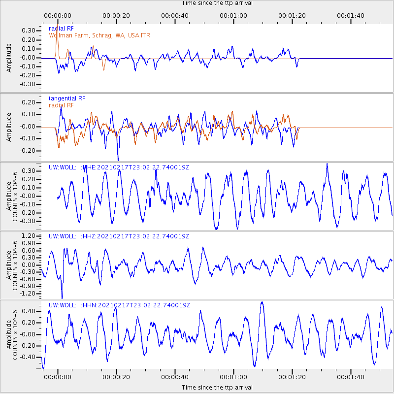
WOLL Wollman Farm, Schrag, WA, USA - Earthquake Result Viewer
*The percent match for this event was below the threshold and hence no stack was calculated.
| Earthquake location: |
Southeast Of Loyalty Islands |
| Earthquake latitude/longitude: |
-23.2/171.8 |
| Earthquake time(UTC): |
2021/02/17 (048) 22:49:38 GMT |
| Earthquake Depth: |
13 km |
| Earthquake Magnitude: |
6.1 Mww |
| Earthquake Catalog/Contributor: |
NEIC PDE/us |
|
| Network: |
UW Pacific Northwest Regional Seismic Network |
| Station: |
WOLL Wollman Farm, Schrag, WA, USA |
| Lat/Lon: |
47.06 N/118.92 W |
| Elevation: |
385 m |
|
| Distance: |
93.6 deg |
| Az: |
39.863 deg |
| Baz: |
239.612 deg |
| Ray Param: |
$rayparam |
*The percent match for this event was below the threshold and hence was not used in the summary stack. |
|
| Radial Match: |
44.16994 % |
| Radial Bump: |
400 |
| Transverse Match: |
75.105034 % |
| Transverse Bump: |
381 |
| SOD ConfigId: |
23341671 |
| Insert Time: |
2021-03-04 00:08:48.217 +0000 |
| GWidth: |
2.5 |
| Max Bumps: |
400 |
| Tol: |
0.001 |
|
Signal To Noise
| Channel | StoN | STA | LTA |
| UW:WOLL: :HHZ:20210217T23:02:22.740019Z | 2.3584707 | 5.4311397E-7 | 2.3028228E-7 |
| UW:WOLL: :HHN:20210217T23:02:22.740019Z | 0.70625514 | 1.6058927E-7 | 2.2738139E-7 |
| UW:WOLL: :HHE:20210217T23:02:22.740019Z | 0.93872577 | 1.6280528E-7 | 1.7343221E-7 |
| Arrivals |
| Ps | |
| PpPs | |
| PsPs/PpSs | |


