
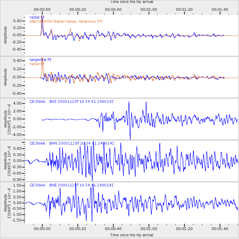
SNAA AWI/GEOFON Station Sanae, Antarctica - Earthquake Result Viewer
| ||||||||||||||||||
| ||||||||||||||||||
| ||||||||||||||||||
|
Signal To Noise
| Channel | StoN | STA | LTA |
| GE:SNAA: :BHN:20001129T10:34:41.249014Z | 2.1308682 | 1.1097759E-7 | 5.2080924E-8 |
| GE:SNAA: :BHE:20001129T10:34:41.249014Z | 5.212873 | 3.6258913E-7 | 6.9556485E-8 |
| GE:SNAA: :BHZ:20001129T10:34:41.249014Z | 12.243545 | 9.8188E-7 | 8.019573E-8 |
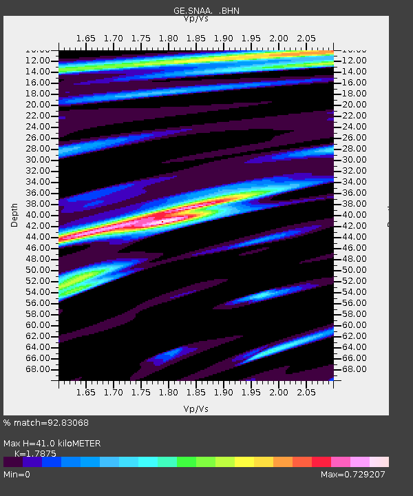
| Arrivals | |
| Ps | 5.3 SECOND |
| PpPs | 17 SECOND |
| PsPs/PpSs | 22 SECOND |

