You are here: Home > Network List > G - GEOSCOPE Stations List
> Station AIS New Amsterdam, Indian Ocean > Earthquake Result Viewer
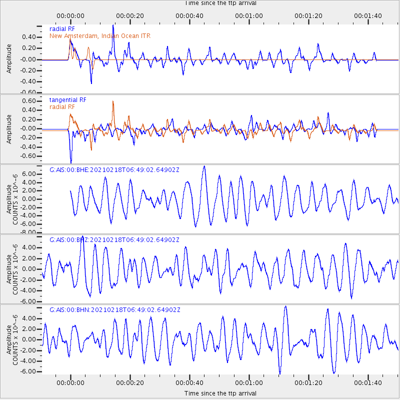
AIS New Amsterdam, Indian Ocean - Earthquake Result Viewer
*The percent match for this event was below the threshold and hence no stack was calculated.
| Earthquake location: |
Vanuatu Islands Region |
| Earthquake latitude/longitude: |
-19.0/167.9 |
| Earthquake time(UTC): |
2021/02/18 (049) 06:37:30 GMT |
| Earthquake Depth: |
10 km |
| Earthquake Magnitude: |
6.2 mww |
| Earthquake Catalog/Contributor: |
NEIC PDE/us |
|
| Network: |
G GEOSCOPE |
| Station: |
AIS New Amsterdam, Indian Ocean |
| Lat/Lon: |
37.80 S/77.57 E |
| Elevation: |
35 m |
|
| Distance: |
78.8 deg |
| Az: |
233.843 deg |
| Baz: |
105.349 deg |
| Ray Param: |
$rayparam |
*The percent match for this event was below the threshold and hence was not used in the summary stack. |
|
| Radial Match: |
63.24088 % |
| Radial Bump: |
338 |
| Transverse Match: |
64.29763 % |
| Transverse Bump: |
400 |
| SOD ConfigId: |
23341671 |
| Insert Time: |
2021-03-04 07:47:28.881 +0000 |
| GWidth: |
2.5 |
| Max Bumps: |
400 |
| Tol: |
0.001 |
|
Signal To Noise
| Channel | StoN | STA | LTA |
| G:AIS:00:BHZ:20210218T06:49:02.64902Z | 2.1579776 | 3.02901E-6 | 1.4036337E-6 |
| G:AIS:00:BHN:20210218T06:49:02.64902Z | 1.2539649 | 1.9458148E-6 | 1.5517297E-6 |
| G:AIS:00:BHE:20210218T06:49:02.64902Z | 0.53647786 | 1.4419675E-6 | 2.6878413E-6 |
| Arrivals |
| Ps | |
| PpPs | |
| PsPs/PpSs | |


