You are here: Home > Network List > IW - Intermountain West Stations List
> Station PLID Pearl Lake, Idaho, USA > Earthquake Result Viewer
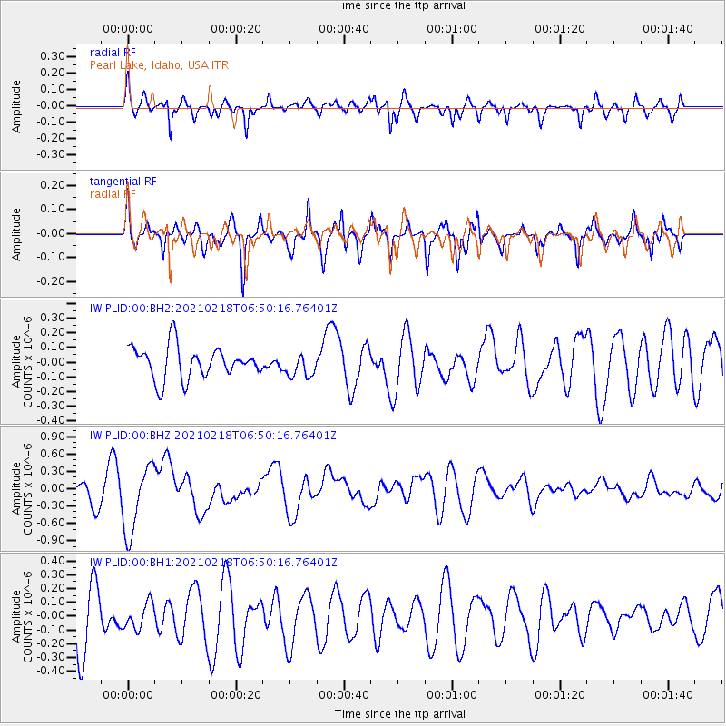
PLID Pearl Lake, Idaho, USA - Earthquake Result Viewer
*The percent match for this event was below the threshold and hence no stack was calculated.
| Earthquake location: |
Vanuatu Islands Region |
| Earthquake latitude/longitude: |
-19.0/167.9 |
| Earthquake time(UTC): |
2021/02/18 (049) 06:37:30 GMT |
| Earthquake Depth: |
10 km |
| Earthquake Magnitude: |
6.2 mww |
| Earthquake Catalog/Contributor: |
NEIC PDE/us |
|
| Network: |
IW Intermountain West |
| Station: |
PLID Pearl Lake, Idaho, USA |
| Lat/Lon: |
45.09 N/116.00 W |
| Elevation: |
2164 m |
|
| Distance: |
93.9 deg |
| Az: |
43.572 deg |
| Baz: |
247.011 deg |
| Ray Param: |
$rayparam |
*The percent match for this event was below the threshold and hence was not used in the summary stack. |
|
| Radial Match: |
61.615704 % |
| Radial Bump: |
345 |
| Transverse Match: |
55.45756 % |
| Transverse Bump: |
301 |
| SOD ConfigId: |
23341671 |
| Insert Time: |
2021-03-04 07:48:27.273 +0000 |
| GWidth: |
2.5 |
| Max Bumps: |
400 |
| Tol: |
0.001 |
|
Signal To Noise
| Channel | StoN | STA | LTA |
| IW:PLID:00:BHZ:20210218T06:50:16.76401Z | 2.4823883 | 5.973207E-7 | 2.406234E-7 |
| IW:PLID:00:BH1:20210218T06:50:16.76401Z | 0.42432818 | 9.3437905E-8 | 2.2020197E-7 |
| IW:PLID:00:BH2:20210218T06:50:16.76401Z | 0.71327955 | 7.803088E-8 | 1.09397334E-7 |
| Arrivals |
| Ps | |
| PpPs | |
| PsPs/PpSs | |


