
SNAA AWI/GEOFON Station Sanae, Antarctica - Earthquake Result Viewer
| ||||||||||||||||||
| ||||||||||||||||||
| ||||||||||||||||||
|
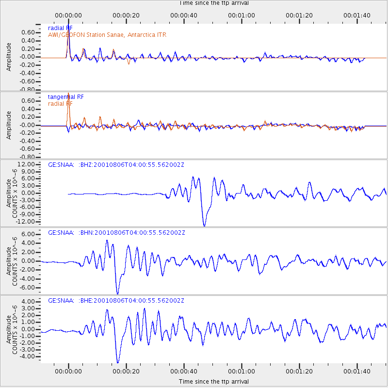
Signal To Noise
| Channel | StoN | STA | LTA |
| GE:SNAA: :BHN:20010806T04:00:55.562002Z | 4.2246556 | 3.754061E-7 | 8.886076E-8 |
| GE:SNAA: :BHE:20010806T04:00:55.562002Z | 1.3673164 | 5.733796E-7 | 4.193467E-7 |
| GE:SNAA: :BHZ:20010806T04:00:55.562002Z | 4.12776 | 6.71585E-7 | 1.6269964E-7 |
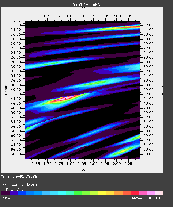
| Arrivals | |
| Ps | 5.6 SECOND |
| PpPs | 18 SECOND |
| PsPs/PpSs | 23 SECOND |

