You are here: Home > Network List > US - United States National Seismic Network Stations List
> Station HAWA Hanford, Washington, USA > Earthquake Result Viewer
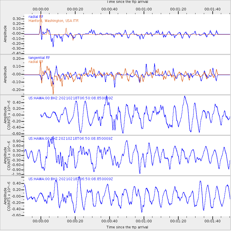
HAWA Hanford, Washington, USA - Earthquake Result Viewer
*The percent match for this event was below the threshold and hence no stack was calculated.
| Earthquake location: |
Vanuatu Islands Region |
| Earthquake latitude/longitude: |
-19.0/167.9 |
| Earthquake time(UTC): |
2021/02/18 (049) 06:37:30 GMT |
| Earthquake Depth: |
10 km |
| Earthquake Magnitude: |
6.2 mww |
| Earthquake Catalog/Contributor: |
NEIC PDE/us |
|
| Network: |
US United States National Seismic Network |
| Station: |
HAWA Hanford, Washington, USA |
| Lat/Lon: |
46.39 N/119.53 W |
| Elevation: |
364 m |
|
| Distance: |
92.2 deg |
| Az: |
41.365 deg |
| Baz: |
244.605 deg |
| Ray Param: |
$rayparam |
*The percent match for this event was below the threshold and hence was not used in the summary stack. |
|
| Radial Match: |
66.47195 % |
| Radial Bump: |
400 |
| Transverse Match: |
44.16082 % |
| Transverse Bump: |
357 |
| SOD ConfigId: |
23341671 |
| Insert Time: |
2021-03-04 07:52:44.285 +0000 |
| GWidth: |
2.5 |
| Max Bumps: |
400 |
| Tol: |
0.001 |
|
Signal To Noise
| Channel | StoN | STA | LTA |
| US:HAWA:00:BHZ:20210218T06:50:08.850009Z | 1.4729737 | 6.0178013E-7 | 4.0854778E-7 |
| US:HAWA:00:BH1:20210218T06:50:08.850009Z | 0.5010959 | 1.0368579E-7 | 2.0691806E-7 |
| US:HAWA:00:BH2:20210218T06:50:08.850009Z | 0.8360277 | 1.6415403E-7 | 1.9634999E-7 |
| Arrivals |
| Ps | |
| PpPs | |
| PsPs/PpSs | |


