You are here: Home > Network List > UW - Pacific Northwest Regional Seismic Network Stations List
> Station LON Longmire CREST broad-band > Earthquake Result Viewer
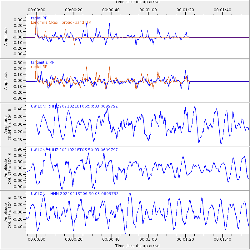
LON Longmire CREST broad-band - Earthquake Result Viewer
*The percent match for this event was below the threshold and hence no stack was calculated.
| Earthquake location: |
Vanuatu Islands Region |
| Earthquake latitude/longitude: |
-19.0/167.9 |
| Earthquake time(UTC): |
2021/02/18 (049) 06:37:30 GMT |
| Earthquake Depth: |
10 km |
| Earthquake Magnitude: |
6.2 mww |
| Earthquake Catalog/Contributor: |
NEIC PDE/us |
|
| Network: |
UW Pacific Northwest Regional Seismic Network |
| Station: |
LON Longmire CREST broad-band |
| Lat/Lon: |
46.75 N/121.81 W |
| Elevation: |
853 m |
|
| Distance: |
90.9 deg |
| Az: |
40.35 deg |
| Baz: |
242.984 deg |
| Ray Param: |
$rayparam |
*The percent match for this event was below the threshold and hence was not used in the summary stack. |
|
| Radial Match: |
64.53961 % |
| Radial Bump: |
273 |
| Transverse Match: |
51.57482 % |
| Transverse Bump: |
400 |
| SOD ConfigId: |
23341671 |
| Insert Time: |
2021-03-04 07:53:43.866 +0000 |
| GWidth: |
2.5 |
| Max Bumps: |
400 |
| Tol: |
0.001 |
|
Signal To Noise
| Channel | StoN | STA | LTA |
| UW:LON: :HHZ:20210218T06:50:03.069979Z | 2.4992747 | 4.8809693E-7 | 1.9529544E-7 |
| UW:LON: :HHN:20210218T06:50:03.069979Z | 2.4516015 | 3.246763E-7 | 1.3243437E-7 |
| UW:LON: :HHE:20210218T06:50:03.069979Z | 0.99379426 | 2.2700016E-7 | 2.2841766E-7 |
| Arrivals |
| Ps | |
| PpPs | |
| PsPs/PpSs | |


