You are here: Home > Network List > AK - Alaska Regional Network Stations List
> Station MDM Murphy Dome > Earthquake Result Viewer
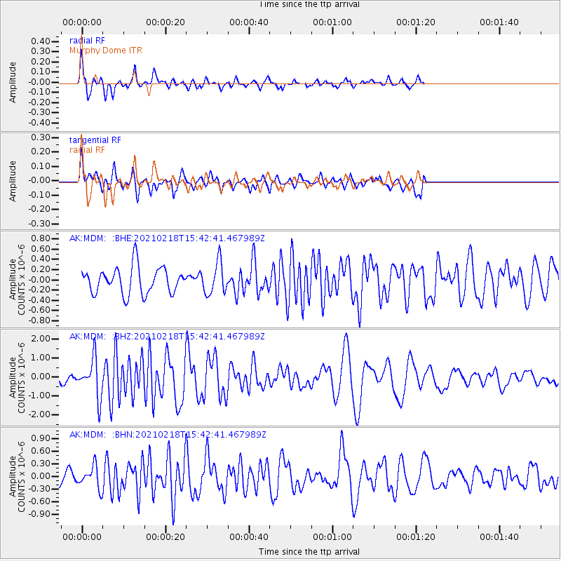
MDM Murphy Dome - Earthquake Result Viewer
*The percent match for this event was below the threshold and hence no stack was calculated.
| Earthquake location: |
Fiji Islands Region |
| Earthquake latitude/longitude: |
-14.9/-176.7 |
| Earthquake time(UTC): |
2021/02/18 (049) 15:30:50 GMT |
| Earthquake Depth: |
10 km |
| Earthquake Magnitude: |
6.1 mww |
| Earthquake Catalog/Contributor: |
NEIC PDE/us |
|
| Network: |
AK Alaska Regional Network |
| Station: |
MDM Murphy Dome |
| Lat/Lon: |
64.96 N/148.23 W |
| Elevation: |
634 m |
|
| Distance: |
82.5 deg |
| Az: |
11.825 deg |
| Baz: |
207.745 deg |
| Ray Param: |
$rayparam |
*The percent match for this event was below the threshold and hence was not used in the summary stack. |
|
| Radial Match: |
80.99027 % |
| Radial Bump: |
304 |
| Transverse Match: |
64.09959 % |
| Transverse Bump: |
400 |
| SOD ConfigId: |
23341671 |
| Insert Time: |
2021-03-04 16:33:18.307 +0000 |
| GWidth: |
2.5 |
| Max Bumps: |
400 |
| Tol: |
0.001 |
|
Signal To Noise
| Channel | StoN | STA | LTA |
| AK:MDM: :BHZ:20210218T15:42:41.467989Z | 5.1182218 | 1.0470161E-6 | 2.0456639E-7 |
| AK:MDM: :BHN:20210218T15:42:41.467989Z | 1.1722525 | 2.715421E-7 | 2.3164131E-7 |
| AK:MDM: :BHE:20210218T15:42:41.467989Z | 1.2363635 | 3.1622218E-7 | 2.55768E-7 |
| Arrivals |
| Ps | |
| PpPs | |
| PsPs/PpSs | |


