
SNAA GEOFON/AWI Station Sanae, Antarctica - Earthquake Result Viewer
| ||||||||||||||||||
| ||||||||||||||||||
| ||||||||||||||||||
|
Signal To Noise
| Channel | StoN | STA | LTA |
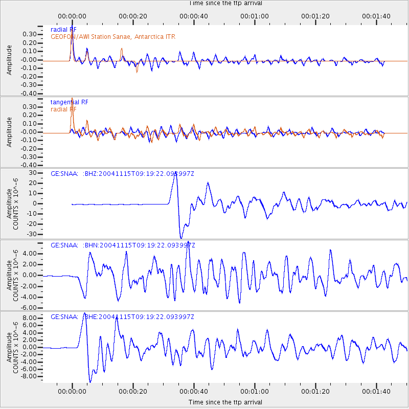
| GE:SNAA: :BHN:20041115T09:19:22.093997Z | 28.907024 | 1.903263E-6 | 6.584085E-8 |
| GE:SNAA: :BHE:20041115T09:19:22.093997Z | 62.230385 | 4.6382484E-6 | 7.4533496E-8 |
| GE:SNAA: :BHZ:20041115T09:19:22.093997Z | 165.94456 | 1.49785565E-5 | 9.026241E-8 |
| Arrivals | |
| Ps | 5.0 SECOND |
| PpPs | 17 SECOND |
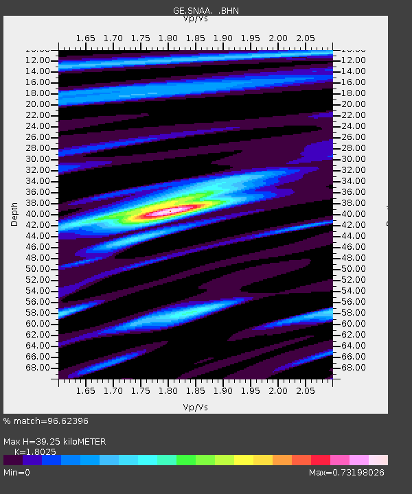
| PsPs/PpSs | 22 SECOND |

