You are here: Home > Network List > CI - Caltech Regional Seismic Network Stations List
> Station MPM Manuel Prospect Mine, California, USA > Earthquake Result Viewer
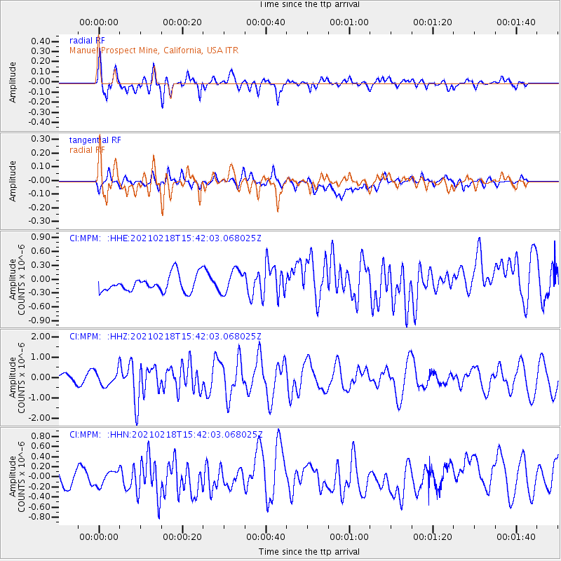
MPM Manuel Prospect Mine, California, USA - Earthquake Result Viewer
*The percent match for this event was below the threshold and hence no stack was calculated.
| Earthquake location: |
Fiji Islands Region |
| Earthquake latitude/longitude: |
-14.9/-176.7 |
| Earthquake time(UTC): |
2021/02/18 (049) 15:30:50 GMT |
| Earthquake Depth: |
10 km |
| Earthquake Magnitude: |
6.1 mww |
| Earthquake Catalog/Contributor: |
NEIC PDE/us |
|
| Network: |
CI Caltech Regional Seismic Network |
| Station: |
MPM Manuel Prospect Mine, California, USA |
| Lat/Lon: |
36.06 N/117.49 W |
| Elevation: |
185 m |
|
| Distance: |
75.5 deg |
| Az: |
46.007 deg |
| Baz: |
239.145 deg |
| Ray Param: |
$rayparam |
*The percent match for this event was below the threshold and hence was not used in the summary stack. |
|
| Radial Match: |
79.45542 % |
| Radial Bump: |
400 |
| Transverse Match: |
43.20038 % |
| Transverse Bump: |
400 |
| SOD ConfigId: |
23341671 |
| Insert Time: |
2021-03-04 16:39:24.355 +0000 |
| GWidth: |
2.5 |
| Max Bumps: |
400 |
| Tol: |
0.001 |
|
Signal To Noise
| Channel | StoN | STA | LTA |
| CI:MPM: :HHZ:20210218T15:42:03.068025Z | 2.3998241 | 3.629025E-7 | 1.5122046E-7 |
| CI:MPM: :HHN:20210218T15:42:03.068025Z | 0.90918845 | 1.8113776E-7 | 1.9923016E-7 |
| CI:MPM: :HHE:20210218T15:42:03.068025Z | 1.4538581 | 2.6027595E-7 | 1.7902431E-7 |
| Arrivals |
| Ps | |
| PpPs | |
| PsPs/PpSs | |


