You are here: Home > Network List > IW - Intermountain West Stations List
> Station MOOW Moose Ponds, Wyoming, USA > Earthquake Result Viewer
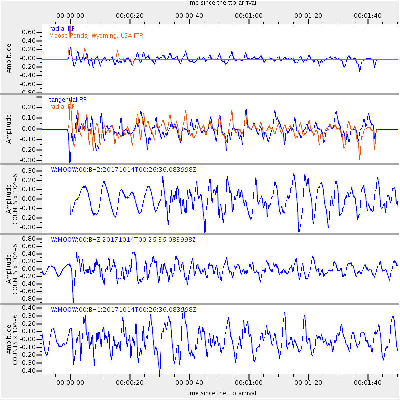
MOOW Moose Ponds, Wyoming, USA - Earthquake Result Viewer
*The percent match for this event was below the threshold and hence no stack was calculated.
| Earthquake location: |
Oaxaca, Mexico |
| Earthquake latitude/longitude: |
16.2/-94.8 |
| Earthquake time(UTC): |
2017/10/14 (287) 00:20:57 GMT |
| Earthquake Depth: |
49 km |
| Earthquake Magnitude: |
5.5 Mww |
| Earthquake Catalog/Contributor: |
NEIC PDE/us |
|
| Network: |
IW Intermountain West |
| Station: |
MOOW Moose Ponds, Wyoming, USA |
| Lat/Lon: |
43.75 N/110.74 W |
| Elevation: |
2128 m |
|
| Distance: |
30.6 deg |
| Az: |
336.988 deg |
| Baz: |
148.788 deg |
| Ray Param: |
$rayparam |
*The percent match for this event was below the threshold and hence was not used in the summary stack. |
|
| Radial Match: |
53.680473 % |
| Radial Bump: |
400 |
| Transverse Match: |
64.34346 % |
| Transverse Bump: |
400 |
| SOD ConfigId: |
2364251 |
| Insert Time: |
2017-10-28 00:22:26.897 +0000 |
| GWidth: |
2.5 |
| Max Bumps: |
400 |
| Tol: |
0.001 |
|
Signal To Noise
| Channel | StoN | STA | LTA |
| IW:MOOW:00:BHZ:20171014T00:26:36.083998Z | 2.5190294 | 3.0096479E-7 | 1.194765E-7 |
| IW:MOOW:00:BH1:20171014T00:26:36.083998Z | 1.4382526 | 1.5435756E-7 | 1.07323E-7 |
| IW:MOOW:00:BH2:20171014T00:26:36.083998Z | 1.0974787 | 1.1301791E-7 | 1.0297959E-7 |
| Arrivals |
| Ps | |
| PpPs | |
| PsPs/PpSs | |


