You are here: Home > Network List > TA - USArray Transportable Network (new EarthScope stations) Stations List
> Station F31M Tsiigehtchic, NWT, CAN > Earthquake Result Viewer
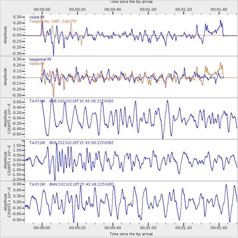
F31M Tsiigehtchic, NWT, CAN - Earthquake Result Viewer
*The percent match for this event was below the threshold and hence no stack was calculated.
| Earthquake location: |
Fiji Islands Region |
| Earthquake latitude/longitude: |
-14.9/-176.7 |
| Earthquake time(UTC): |
2021/02/18 (049) 15:30:50 GMT |
| Earthquake Depth: |
10 km |
| Earthquake Magnitude: |
6.1 mww |
| Earthquake Catalog/Contributor: |
NEIC PDE/us |
|
| Network: |
TA USArray Transportable Network (new EarthScope stations) |
| Station: |
F31M Tsiigehtchic, NWT, CAN |
| Lat/Lon: |
67.44 N/133.74 W |
| Elevation: |
56 m |
|
| Distance: |
87.9 deg |
| Az: |
15.267 deg |
| Baz: |
221.29 deg |
| Ray Param: |
$rayparam |
*The percent match for this event was below the threshold and hence was not used in the summary stack. |
|
| Radial Match: |
56.112854 % |
| Radial Bump: |
400 |
| Transverse Match: |
60.043518 % |
| Transverse Bump: |
386 |
| SOD ConfigId: |
23341671 |
| Insert Time: |
2021-03-04 16:47:36.100 +0000 |
| GWidth: |
2.5 |
| Max Bumps: |
400 |
| Tol: |
0.001 |
|
Signal To Noise
| Channel | StoN | STA | LTA |
| TA:F31M: :BHZ:20210218T15:43:08.225008Z | 3.045069 | 6.9479694E-7 | 2.2817117E-7 |
| TA:F31M: :BHN:20210218T15:43:08.225008Z | 1.252263 | 4.031834E-7 | 3.2196385E-7 |
| TA:F31M: :BHE:20210218T15:43:08.225008Z | 1.0583305 | 3.7735288E-7 | 3.5655484E-7 |
| Arrivals |
| Ps | |
| PpPs | |
| PsPs/PpSs | |


