You are here: Home > Network List > TA - USArray Transportable Network (new EarthScope stations) Stations List
> Station H31M Peel River, Yukon, CAN > Earthquake Result Viewer
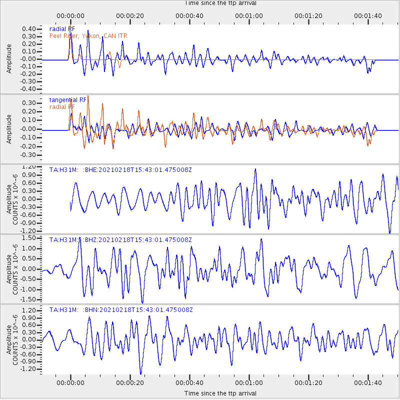
H31M Peel River, Yukon, CAN - Earthquake Result Viewer
*The percent match for this event was below the threshold and hence no stack was calculated.
| Earthquake location: |
Fiji Islands Region |
| Earthquake latitude/longitude: |
-14.9/-176.7 |
| Earthquake time(UTC): |
2021/02/18 (049) 15:30:50 GMT |
| Earthquake Depth: |
10 km |
| Earthquake Magnitude: |
6.1 mww |
| Earthquake Catalog/Contributor: |
NEIC PDE/us |
|
| Network: |
TA USArray Transportable Network (new EarthScope stations) |
| Station: |
H31M Peel River, Yukon, CAN |
| Lat/Lon: |
65.81 N/134.34 W |
| Elevation: |
642 m |
|
| Distance: |
86.5 deg |
| Az: |
16.166 deg |
| Baz: |
220.784 deg |
| Ray Param: |
$rayparam |
*The percent match for this event was below the threshold and hence was not used in the summary stack. |
|
| Radial Match: |
77.34291 % |
| Radial Bump: |
400 |
| Transverse Match: |
52.98721 % |
| Transverse Bump: |
400 |
| SOD ConfigId: |
23341671 |
| Insert Time: |
2021-03-04 16:47:54.005 +0000 |
| GWidth: |
2.5 |
| Max Bumps: |
400 |
| Tol: |
0.001 |
|
Signal To Noise
| Channel | StoN | STA | LTA |
| TA:H31M: :BHZ:20210218T15:43:01.475008Z | 3.0064883 | 7.8594894E-7 | 2.614176E-7 |
| TA:H31M: :BHN:20210218T15:43:01.475008Z | 1.5040128 | 3.0335238E-7 | 2.0169533E-7 |
| TA:H31M: :BHE:20210218T15:43:01.475008Z | 0.80494356 | 2.3110745E-7 | 2.871101E-7 |
| Arrivals |
| Ps | |
| PpPs | |
| PsPs/PpSs | |


