You are here: Home > Network List > US - United States National Seismic Network Stations List
> Station DGMT Dagmar, Montana, USA > Earthquake Result Viewer
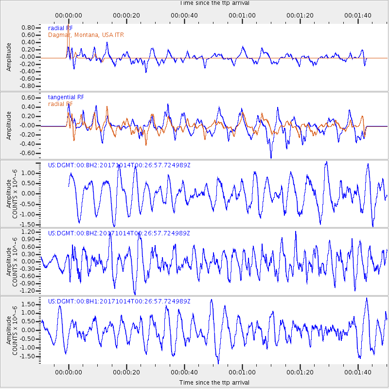
DGMT Dagmar, Montana, USA - Earthquake Result Viewer
*The percent match for this event was below the threshold and hence no stack was calculated.
| Earthquake location: |
Oaxaca, Mexico |
| Earthquake latitude/longitude: |
16.2/-94.8 |
| Earthquake time(UTC): |
2017/10/14 (287) 00:20:57 GMT |
| Earthquake Depth: |
49 km |
| Earthquake Magnitude: |
5.5 Mww |
| Earthquake Catalog/Contributor: |
NEIC PDE/us |
|
| Network: |
US United States National Seismic Network |
| Station: |
DGMT Dagmar, Montana, USA |
| Lat/Lon: |
48.47 N/104.20 W |
| Elevation: |
0.0 m |
|
| Distance: |
33.1 deg |
| Az: |
348.527 deg |
| Baz: |
163.315 deg |
| Ray Param: |
$rayparam |
*The percent match for this event was below the threshold and hence was not used in the summary stack. |
|
| Radial Match: |
55.48919 % |
| Radial Bump: |
400 |
| Transverse Match: |
70.38953 % |
| Transverse Bump: |
400 |
| SOD ConfigId: |
2364251 |
| Insert Time: |
2017-10-28 00:23:00.349 +0000 |
| GWidth: |
2.5 |
| Max Bumps: |
400 |
| Tol: |
0.001 |
|
Signal To Noise
| Channel | StoN | STA | LTA |
| US:DGMT:00:BHZ:20171014T00:26:57.724989Z | 1.7889264 | 4.1436223E-7 | 2.3162622E-7 |
| US:DGMT:00:BH1:20171014T00:26:57.724989Z | 0.97863436 | 5.1664676E-7 | 5.2792626E-7 |
| US:DGMT:00:BH2:20171014T00:26:57.724989Z | 0.53851455 | 4.102926E-7 | 7.6189696E-7 |
| Arrivals |
| Ps | |
| PpPs | |
| PsPs/PpSs | |


