You are here: Home > Network List > CI - Caltech Regional Seismic Network Stations List
> Station MPM Manuel Prospect Mine, California, USA > Earthquake Result Viewer
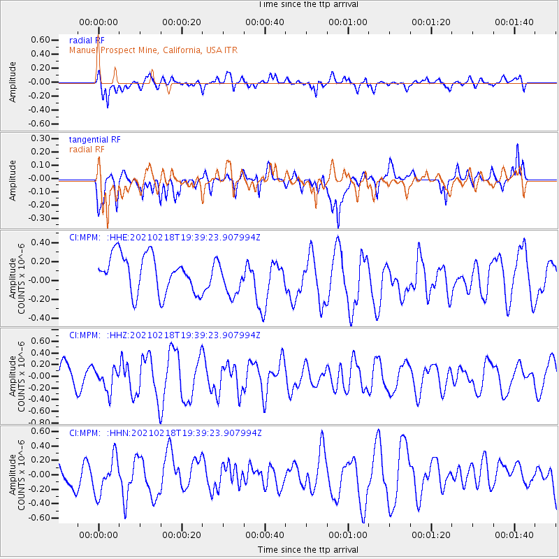
MPM Manuel Prospect Mine, California, USA - Earthquake Result Viewer
*The percent match for this event was below the threshold and hence no stack was calculated.
| Earthquake location: |
Central East Pacific Rise |
| Earthquake latitude/longitude: |
-9.1/-108.2 |
| Earthquake time(UTC): |
2021/02/18 (049) 19:31:33 GMT |
| Earthquake Depth: |
10 km |
| Earthquake Magnitude: |
5.8 Mww |
| Earthquake Catalog/Contributor: |
NEIC PDE/us |
|
| Network: |
CI Caltech Regional Seismic Network |
| Station: |
MPM Manuel Prospect Mine, California, USA |
| Lat/Lon: |
36.06 N/117.49 W |
| Elevation: |
185 m |
|
| Distance: |
45.8 deg |
| Az: |
349.466 deg |
| Baz: |
167.126 deg |
| Ray Param: |
$rayparam |
*The percent match for this event was below the threshold and hence was not used in the summary stack. |
|
| Radial Match: |
43.411667 % |
| Radial Bump: |
400 |
| Transverse Match: |
63.619335 % |
| Transverse Bump: |
400 |
| SOD ConfigId: |
23341671 |
| Insert Time: |
2021-03-04 20:44:17.076 +0000 |
| GWidth: |
2.5 |
| Max Bumps: |
400 |
| Tol: |
0.001 |
|
Signal To Noise
| Channel | StoN | STA | LTA |
| CI:MPM: :HHZ:20210218T19:39:23.907994Z | 0.966841 | 1.8959534E-7 | 1.9609774E-7 |
| CI:MPM: :HHN:20210218T19:39:23.907994Z | 1.3596574 | 2.546022E-7 | 1.8725468E-7 |
| CI:MPM: :HHE:20210218T19:39:23.907994Z | 0.93063974 | 1.8260532E-7 | 1.9621483E-7 |
| Arrivals |
| Ps | |
| PpPs | |
| PsPs/PpSs | |


