You are here: Home > Network List > GS - US Geological Survey Networks Stations List
> Station DEC09 Kile Street Surface Site > Earthquake Result Viewer
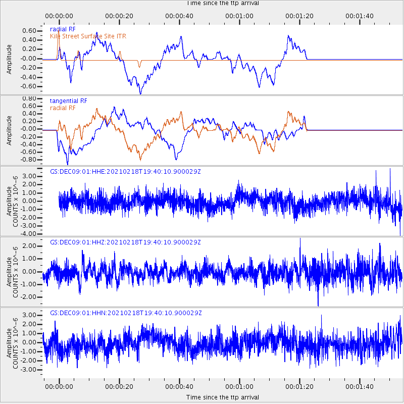
DEC09 Kile Street Surface Site - Earthquake Result Viewer
*The percent match for this event was below the threshold and hence no stack was calculated.
| Earthquake location: |
Central East Pacific Rise |
| Earthquake latitude/longitude: |
-9.1/-108.2 |
| Earthquake time(UTC): |
2021/02/18 (049) 19:31:33 GMT |
| Earthquake Depth: |
10 km |
| Earthquake Magnitude: |
5.8 Mww |
| Earthquake Catalog/Contributor: |
NEIC PDE/us |
|
| Network: |
GS US Geological Survey Networks |
| Station: |
DEC09 Kile Street Surface Site |
| Lat/Lon: |
39.87 N/88.92 W |
| Elevation: |
207 m |
|
| Distance: |
51.9 deg |
| Az: |
18.819 deg |
| Baz: |
204.454 deg |
| Ray Param: |
$rayparam |
*The percent match for this event was below the threshold and hence was not used in the summary stack. |
|
| Radial Match: |
51.358402 % |
| Radial Bump: |
400 |
| Transverse Match: |
53.697018 % |
| Transverse Bump: |
400 |
| SOD ConfigId: |
23341671 |
| Insert Time: |
2021-03-04 20:47:19.427 +0000 |
| GWidth: |
2.5 |
| Max Bumps: |
400 |
| Tol: |
0.001 |
|
Signal To Noise
| Channel | StoN | STA | LTA |
| GS:DEC09:01:HHZ:20210218T19:40:10.900029Z | 0.9729151 | 4.8227685E-7 | 4.957029E-7 |
| GS:DEC09:01:HHN:20210218T19:40:10.900029Z | 1.2055975 | 1.0551007E-6 | 8.7516827E-7 |
| GS:DEC09:01:HHE:20210218T19:40:10.900029Z | 1.0030496 | 7.597265E-7 | 7.5741673E-7 |
| Arrivals |
| Ps | |
| PpPs | |
| PsPs/PpSs | |


