You are here: Home > Network List > GE - GEOFON Stations List
> Station SNAA AWI/GEOFON Station Sanae, Antarctica > Earthquake Result Viewer
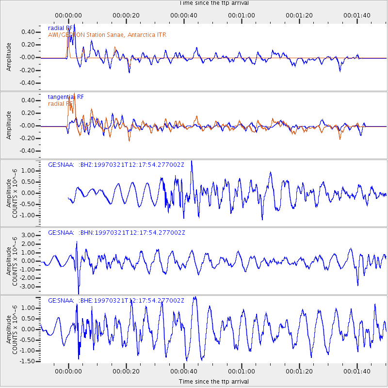
SNAA AWI/GEOFON Station Sanae, Antarctica - Earthquake Result Viewer
*The percent match for this event was below the threshold and hence no stack was calculated.
| Earthquake location: |
Kermadec Islands Region |
| Earthquake latitude/longitude: |
-31.2/179.6 |
| Earthquake time(UTC): |
1997/03/21 (080) 12:07:17 GMT |
| Earthquake Depth: |
449 km |
| Earthquake Magnitude: |
5.6 MB, 6.3 UNKNOWN, 6.2 MW |
| Earthquake Catalog/Contributor: |
WHDF/NEIC |
|
| Network: |
GE GEOFON |
| Station: |
SNAA AWI/GEOFON Station Sanae, Antarctica |
| Lat/Lon: |
71.67 S/2.84 W |
| Elevation: |
846 m |
|
| Distance: |
77.4 deg |
| Az: |
179.202 deg |
| Baz: |
182.162 deg |
| Ray Param: |
$rayparam |
*The percent match for this event was below the threshold and hence was not used in the summary stack. |
|
| Radial Match: |
76.38847 % |
| Radial Bump: |
400 |
| Transverse Match: |
45.14108 % |
| Transverse Bump: |
400 |
| SOD ConfigId: |
4480 |
| Insert Time: |
2010-03-09 05:41:44.361 +0000 |
| GWidth: |
2.5 |
| Max Bumps: |
400 |
| Tol: |
0.001 |
|
Signal To Noise
| Channel | StoN | STA | LTA |
| GE:SNAA: :BHN:19970321T12:17:54.277002Z | 2.520172 | 1.1952474E-6 | 4.7427213E-7 |
| GE:SNAA: :BHE:19970321T12:17:54.277002Z | 0.9198972 | 4.9748854E-7 | 5.4080886E-7 |
| GE:SNAA: :BHZ:19970321T12:17:54.277002Z | 1.6872001 | 4.5922252E-7 | 2.7218024E-7 |
| Arrivals |
| Ps | |
| PpPs | |
| PsPs/PpSs | |


