You are here: Home > Network List > TX - Texas Seismological Network Stations List
> Station WTFS Witchita Falls > Earthquake Result Viewer
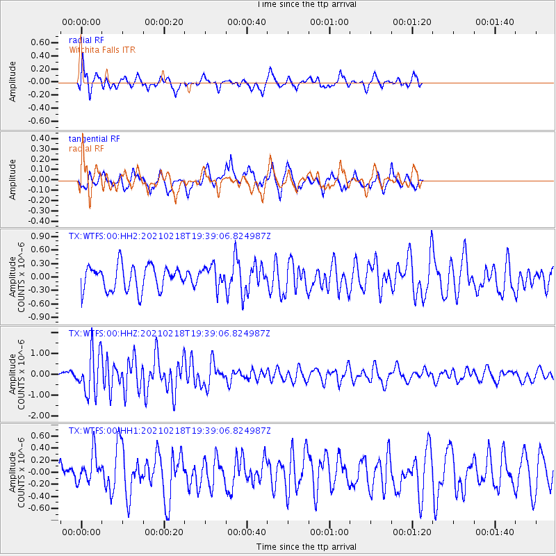
WTFS Witchita Falls - Earthquake Result Viewer
*The percent match for this event was below the threshold and hence no stack was calculated.
| Earthquake location: |
Central East Pacific Rise |
| Earthquake latitude/longitude: |
-9.1/-108.2 |
| Earthquake time(UTC): |
2021/02/18 (049) 19:31:33 GMT |
| Earthquake Depth: |
10 km |
| Earthquake Magnitude: |
5.8 Mww |
| Earthquake Catalog/Contributor: |
NEIC PDE/us |
|
| Network: |
TX Texas Seismological Network |
| Station: |
WTFS Witchita Falls |
| Lat/Lon: |
33.77 N/98.46 W |
| Elevation: |
277 m |
|
| Distance: |
43.6 deg |
| Az: |
11.763 deg |
| Baz: |
193.985 deg |
| Ray Param: |
$rayparam |
*The percent match for this event was below the threshold and hence was not used in the summary stack. |
|
| Radial Match: |
62.166023 % |
| Radial Bump: |
400 |
| Transverse Match: |
62.255943 % |
| Transverse Bump: |
400 |
| SOD ConfigId: |
23341671 |
| Insert Time: |
2021-03-04 20:57:42.264 +0000 |
| GWidth: |
2.5 |
| Max Bumps: |
400 |
| Tol: |
0.001 |
|
Signal To Noise
| Channel | StoN | STA | LTA |
| TX:WTFS:00:HHZ:20210218T19:39:06.824987Z | 5.9493628 | 1.0439036E-6 | 1.7546476E-7 |
| TX:WTFS:00:HH1:20210218T19:39:06.824987Z | 1.0738876 | 2.5765462E-7 | 2.3992698E-7 |
| TX:WTFS:00:HH2:20210218T19:39:06.824987Z | 0.8741777 | 2.4032127E-7 | 2.7491126E-7 |
| Arrivals |
| Ps | |
| PpPs | |
| PsPs/PpSs | |


