You are here: Home > Network List > GS - US Geological Survey Networks Stations List
> Station OK051 E0350 and S34600 Roads, Ralston, OK > Earthquake Result Viewer
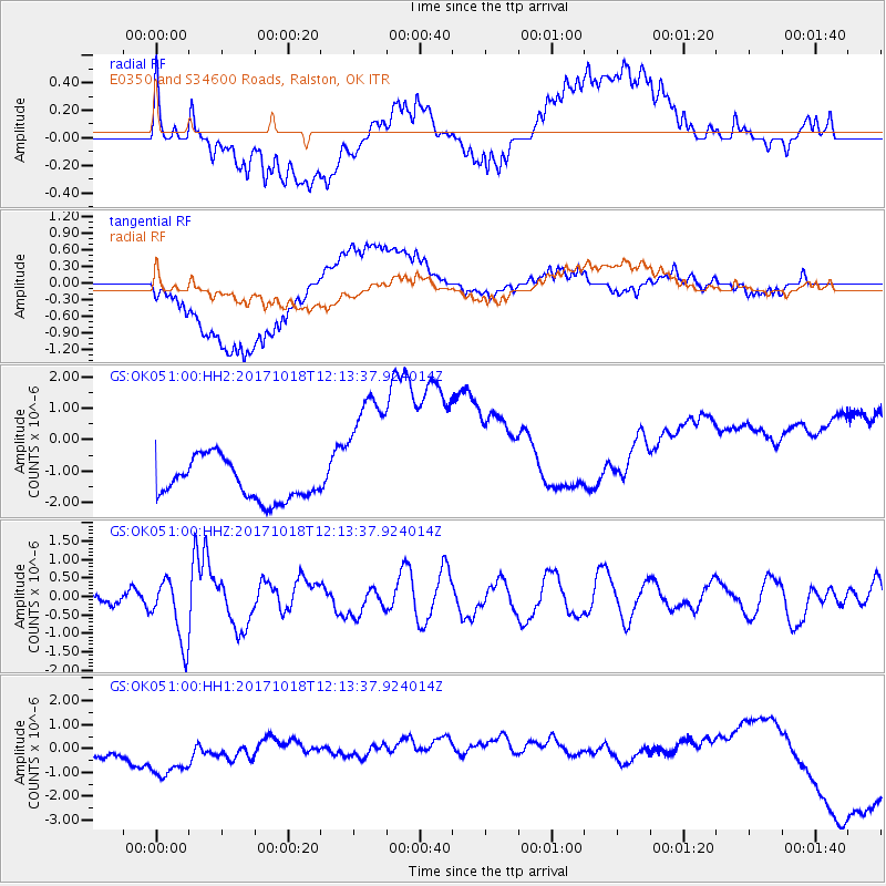
OK051 E0350 and S34600 Roads, Ralston, OK - Earthquake Result Viewer
*The percent match for this event was below the threshold and hence no stack was calculated.
| Earthquake location: |
Tonga Islands |
| Earthquake latitude/longitude: |
-20.6/-173.9 |
| Earthquake time(UTC): |
2017/10/18 (291) 12:00:59 GMT |
| Earthquake Depth: |
10 km |
| Earthquake Magnitude: |
6.0 Mww |
| Earthquake Catalog/Contributor: |
NEIC PDE/us |
|
| Network: |
GS US Geological Survey Networks |
| Station: |
OK051 E0350 and S34600 Roads, Ralston, OK |
| Lat/Lon: |
36.51 N/96.84 W |
| Elevation: |
263 m |
|
| Distance: |
92.2 deg |
| Az: |
51.796 deg |
| Baz: |
246.024 deg |
| Ray Param: |
$rayparam |
*The percent match for this event was below the threshold and hence was not used in the summary stack. |
|
| Radial Match: |
20.759624 % |
| Radial Bump: |
400 |
| Transverse Match: |
43.71622 % |
| Transverse Bump: |
400 |
| SOD ConfigId: |
2364251 |
| Insert Time: |
2017-11-01 12:05:24.197 +0000 |
| GWidth: |
2.5 |
| Max Bumps: |
400 |
| Tol: |
0.001 |
|
Signal To Noise
| Channel | StoN | STA | LTA |
| GS:OK051:00:HHZ:20171018T12:13:37.924014Z | 5.577484 | 8.5601715E-7 | 1.5347729E-7 |
| GS:OK051:00:HH1:20171018T12:13:37.924014Z | 0.66226226 | 7.164978E-7 | 1.0818943E-6 |
| GS:OK051:00:HH2:20171018T12:13:37.924014Z | 3.5620894 | 2.2222525E-6 | 6.238621E-7 |
| Arrivals |
| Ps | |
| PpPs | |
| PsPs/PpSs | |


