You are here: Home > Network List > IU - Global Seismograph Network (GSN - IRIS/USGS) Stations List
> Station POHA Pohakuloa, Hawaii, USA > Earthquake Result Viewer
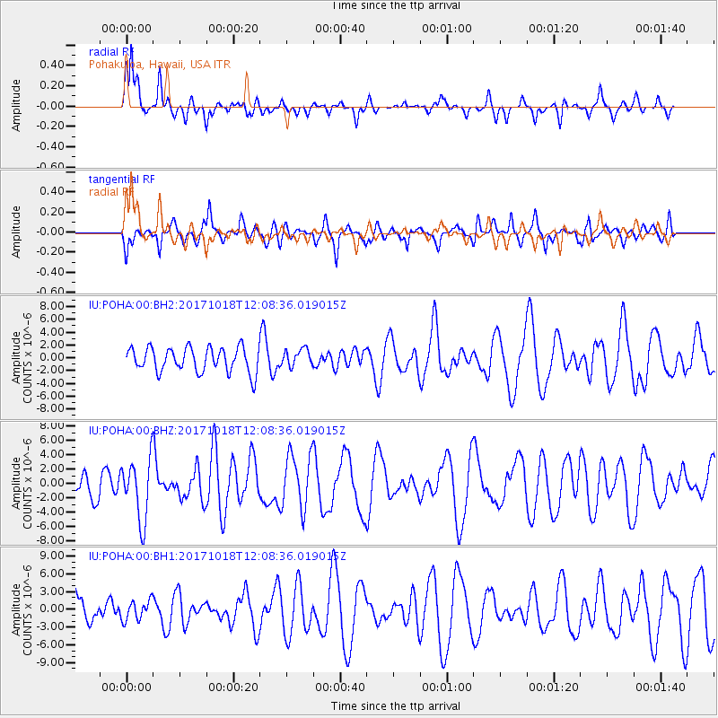
POHA Pohakuloa, Hawaii, USA - Earthquake Result Viewer
*The percent match for this event was below the threshold and hence no stack was calculated.
| Earthquake location: |
Tonga Islands |
| Earthquake latitude/longitude: |
-20.6/-173.9 |
| Earthquake time(UTC): |
2017/10/18 (291) 12:00:59 GMT |
| Earthquake Depth: |
10 km |
| Earthquake Magnitude: |
6.0 Mww |
| Earthquake Catalog/Contributor: |
NEIC PDE/us |
|
| Network: |
IU Global Seismograph Network (GSN - IRIS/USGS) |
| Station: |
POHA Pohakuloa, Hawaii, USA |
| Lat/Lon: |
19.76 N/155.53 W |
| Elevation: |
1990 m |
|
| Distance: |
44.0 deg |
| Az: |
25.309 deg |
| Baz: |
205.165 deg |
| Ray Param: |
$rayparam |
*The percent match for this event was below the threshold and hence was not used in the summary stack. |
|
| Radial Match: |
71.52422 % |
| Radial Bump: |
397 |
| Transverse Match: |
60.035645 % |
| Transverse Bump: |
400 |
| SOD ConfigId: |
2364251 |
| Insert Time: |
2017-11-01 12:07:04.614 +0000 |
| GWidth: |
2.5 |
| Max Bumps: |
400 |
| Tol: |
0.001 |
|
Signal To Noise
| Channel | StoN | STA | LTA |
| IU:POHA:00:BHZ:20171018T12:08:36.019015Z | 1.6649811 | 4.265381E-6 | 2.5618194E-6 |
| IU:POHA:00:BH1:20171018T12:08:36.019015Z | 0.5345425 | 1.667004E-6 | 3.1185618E-6 |
| IU:POHA:00:BH2:20171018T12:08:36.019015Z | 0.70581174 | 1.3400946E-6 | 1.8986574E-6 |
| Arrivals |
| Ps | |
| PpPs | |
| PsPs/PpSs | |


