You are here: Home > Network List > TA - USArray Transportable Network (new EarthScope stations) Stations List
> Station R33M Jennings River, BC, CAN > Earthquake Result Viewer
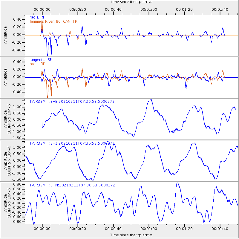
R33M Jennings River, BC, CAN - Earthquake Result Viewer
*The percent match for this event was below the threshold and hence no stack was calculated.
| Earthquake location: |
Southeast Of Loyalty Islands |
| Earthquake latitude/longitude: |
-23.1/171.7 |
| Earthquake time(UTC): |
2021/02/11 (042) 07:24:04 GMT |
| Earthquake Depth: |
10 km |
| Earthquake Magnitude: |
5.5 mb |
| Earthquake Catalog/Contributor: |
NEIC PDE/us |
|
| Network: |
TA USArray Transportable Network (new EarthScope stations) |
| Station: |
R33M Jennings River, BC, CAN |
| Lat/Lon: |
59.39 N/130.97 W |
| Elevation: |
1437 m |
|
| Distance: |
94.6 deg |
| Az: |
25.594 deg |
| Baz: |
231.036 deg |
| Ray Param: |
$rayparam |
*The percent match for this event was below the threshold and hence was not used in the summary stack. |
|
| Radial Match: |
92.231346 % |
| Radial Bump: |
392 |
| Transverse Match: |
54.568962 % |
| Transverse Bump: |
400 |
| SOD ConfigId: |
23341671 |
| Insert Time: |
2021-03-11 12:40:57.098 +0000 |
| GWidth: |
2.5 |
| Max Bumps: |
400 |
| Tol: |
0.001 |
|
Signal To Noise
| Channel | StoN | STA | LTA |
| TA:R33M: :BHZ:20210211T07:36:53.500027Z | 1.3226014 | 8.9828984E-7 | 6.791841E-7 |
| TA:R33M: :BHN:20210211T07:36:53.500027Z | 0.822633 | 2.483404E-7 | 3.0188482E-7 |
| TA:R33M: :BHE:20210211T07:36:53.500027Z | 1.648011 | 8.449103E-7 | 5.1268484E-7 |
| Arrivals |
| Ps | |
| PpPs | |
| PsPs/PpSs | |


