SFJ IRIS/GEOFON Station Sondre Stromfjord, Greenland - Earthquake Result Viewer
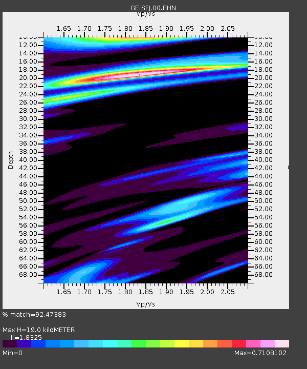
Earthquake location: Andreanof Islands, Aleutian Is.
Earthquake latitude/longitude: 51.6/-177.7
Earthquake time(UTC): 1999/03/20 (079) 10:47:45 GMT
Earthquake Depth: 33 km
Earthquake Magnitude: 6.3 MB, 6.8 MS, 6.9 MW, 6.8 ME
Earthquake Catalog/Contributor: WHDF/NEIC
Network: GE GEOFON
Station: SFJ IRIS/GEOFON Station Sondre Stromfjord, Greenland
Lat/Lon: 67.00 N/50.62 W
Elevation: 365 m
Distance: 55.2 deg
Az: 22.459 deg
Baz: 322.667 deg
Ray Param: 0.06489726
Estimated Moho Depth: 19.0 km
Estimated Crust Vp/Vs: 1.83
Assumed Crust Vp: 6.459 km/s
Estimated Crust Vs: 3.525 km/s
Estimated Crust Poisson's Ratio: 0.29
Radial Match: 92.47383 %
Radial Bump: 283
Transverse Match: 63.480255 %
Transverse Bump: 400
SOD ConfigId: 4480
Insert Time: 2010-03-09 05:43:14.568 +0000
GWidth: 2.5
Max Bumps: 400
Tol: 0.001

Signal To Noise

ChannelStoNSTALTA
GE:SFJ:00:BHN:19990320T10:56:44.72303Z2.75797465.1619813E-61.8716567E-6
GE:SFJ:00:BHE:19990320T10:56:44.72303Z2.3217562.18497E-69.410851E-7
GE:SFJ:00:BHZ:19990320T10:56:44.72303Z1.76821231.359488E-67.6884885E-7
Arrivals
Ps2.6 SECOND
PpPs7.9 SECOND
PsPs/PpSs10 SECOND