You are here: Home > Network List > AV - Alaska Volcano Observatory Stations List
> Station SPCR Ckakachatna River, Mount Spurr, Alaska > Earthquake Result Viewer
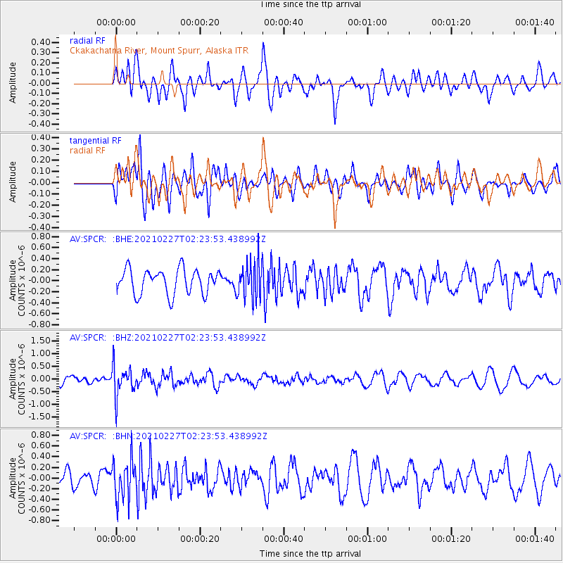
SPCR Ckakachatna River, Mount Spurr, Alaska - Earthquake Result Viewer
*The percent match for this event was below the threshold and hence no stack was calculated.
| Earthquake location: |
Fiji Islands Region |
| Earthquake latitude/longitude: |
-18.5/-177.9 |
| Earthquake time(UTC): |
2021/02/27 (058) 02:13:01 GMT |
| Earthquake Depth: |
554 km |
| Earthquake Magnitude: |
5.6 mww |
| Earthquake Catalog/Contributor: |
NEIC PDE/us |
|
| Network: |
AV Alaska Volcano Observatory |
| Station: |
SPCR Ckakachatna River, Mount Spurr, Alaska |
| Lat/Lon: |
61.20 N/152.21 W |
| Elevation: |
984 m |
|
| Distance: |
82.1 deg |
| Az: |
12.255 deg |
| Baz: |
204.58 deg |
| Ray Param: |
$rayparam |
*The percent match for this event was below the threshold and hence was not used in the summary stack. |
|
| Radial Match: |
69.35006 % |
| Radial Bump: |
400 |
| Transverse Match: |
57.220493 % |
| Transverse Bump: |
400 |
| SOD ConfigId: |
23341671 |
| Insert Time: |
2021-03-13 03:20:51.218 +0000 |
| GWidth: |
2.5 |
| Max Bumps: |
400 |
| Tol: |
0.001 |
|
Signal To Noise
| Channel | StoN | STA | LTA |
| AV:SPCR: :BHZ:20210227T02:23:53.438992Z | 4.1787567 | 6.02348E-7 | 1.4414526E-7 |
| AV:SPCR: :BHN:20210227T02:23:53.438992Z | 1.9103566 | 3.7533766E-7 | 1.9647517E-7 |
| AV:SPCR: :BHE:20210227T02:23:53.438992Z | 1.5040532 | 3.3875003E-7 | 2.2522475E-7 |
| Arrivals |
| Ps | |
| PpPs | |
| PsPs/PpSs | |


