You are here: Home > Network List > US - United States National Seismic Network Stations List
> Station HAWA Hanford, Washington, USA > Earthquake Result Viewer
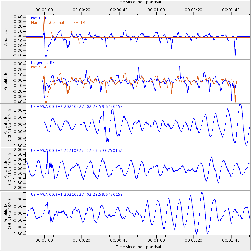
HAWA Hanford, Washington, USA - Earthquake Result Viewer
*The percent match for this event was below the threshold and hence no stack was calculated.
| Earthquake location: |
Fiji Islands Region |
| Earthquake latitude/longitude: |
-18.5/-177.9 |
| Earthquake time(UTC): |
2021/02/27 (058) 02:13:01 GMT |
| Earthquake Depth: |
554 km |
| Earthquake Magnitude: |
5.6 mww |
| Earthquake Catalog/Contributor: |
NEIC PDE/us |
|
| Network: |
US United States National Seismic Network |
| Station: |
HAWA Hanford, Washington, USA |
| Lat/Lon: |
46.39 N/119.53 W |
| Elevation: |
364 m |
|
| Distance: |
83.3 deg |
| Az: |
36.413 deg |
| Baz: |
234.471 deg |
| Ray Param: |
$rayparam |
*The percent match for this event was below the threshold and hence was not used in the summary stack. |
|
| Radial Match: |
61.143127 % |
| Radial Bump: |
400 |
| Transverse Match: |
76.595924 % |
| Transverse Bump: |
387 |
| SOD ConfigId: |
23341671 |
| Insert Time: |
2021-03-13 03:32:30.819 +0000 |
| GWidth: |
2.5 |
| Max Bumps: |
400 |
| Tol: |
0.001 |
|
Signal To Noise
| Channel | StoN | STA | LTA |
| US:HAWA:00:BHZ:20210227T02:23:59.675015Z | 1.1677655 | 7.1067245E-7 | 6.085746E-7 |
| US:HAWA:00:BH1:20210227T02:23:59.675015Z | 0.7614832 | 4.4300282E-7 | 5.817631E-7 |
| US:HAWA:00:BH2:20210227T02:23:59.675015Z | 2.8712175 | 6.8612246E-7 | 2.3896567E-7 |
| Arrivals |
| Ps | |
| PpPs | |
| PsPs/PpSs | |


