You are here: Home > Network List > US - United States National Seismic Network Stations List
> Station WUAZ Wupatki, Arizona, USA > Earthquake Result Viewer
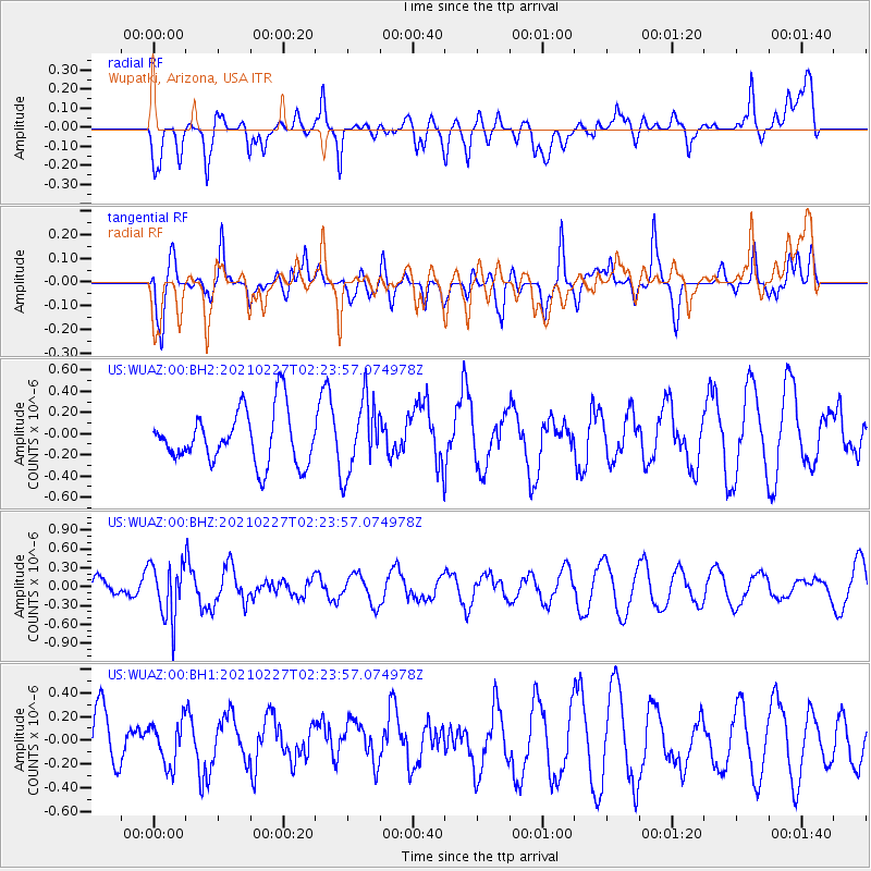
WUAZ Wupatki, Arizona, USA - Earthquake Result Viewer
*The percent match for this event was below the threshold and hence no stack was calculated.
| Earthquake location: |
Fiji Islands Region |
| Earthquake latitude/longitude: |
-18.5/-177.9 |
| Earthquake time(UTC): |
2021/02/27 (058) 02:13:01 GMT |
| Earthquake Depth: |
554 km |
| Earthquake Magnitude: |
5.6 mww |
| Earthquake Catalog/Contributor: |
NEIC PDE/us |
|
| Network: |
US United States National Seismic Network |
| Station: |
WUAZ Wupatki, Arizona, USA |
| Lat/Lon: |
35.52 N/111.37 W |
| Elevation: |
1592 m |
|
| Distance: |
82.8 deg |
| Az: |
48.978 deg |
| Baz: |
241.352 deg |
| Ray Param: |
$rayparam |
*The percent match for this event was below the threshold and hence was not used in the summary stack. |
|
| Radial Match: |
51.389446 % |
| Radial Bump: |
400 |
| Transverse Match: |
46.874233 % |
| Transverse Bump: |
400 |
| SOD ConfigId: |
23341671 |
| Insert Time: |
2021-03-13 03:32:41.165 +0000 |
| GWidth: |
2.5 |
| Max Bumps: |
400 |
| Tol: |
0.001 |
|
Signal To Noise
| Channel | StoN | STA | LTA |
| US:WUAZ:00:BHZ:20210227T02:23:57.074978Z | 2.9815176 | 4.3719788E-7 | 1.4663603E-7 |
| US:WUAZ:00:BH1:20210227T02:23:57.074978Z | 0.7153341 | 1.8207591E-7 | 2.5453267E-7 |
| US:WUAZ:00:BH2:20210227T02:23:57.074978Z | 1.3777169 | 3.4516242E-7 | 2.5053217E-7 |
| Arrivals |
| Ps | |
| PpPs | |
| PsPs/PpSs | |


