You are here: Home > Network List > UU - University of Utah Regional Network Stations List
> Station KNB Kanab, UT, USA > Earthquake Result Viewer
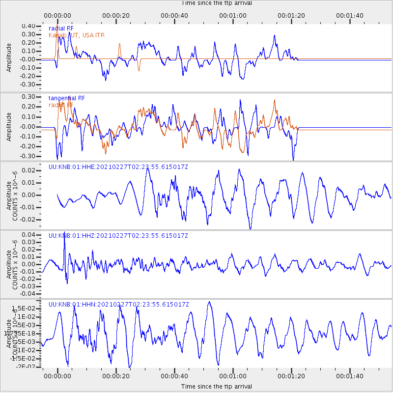
KNB Kanab, UT, USA - Earthquake Result Viewer
*The percent match for this event was below the threshold and hence no stack was calculated.
| Earthquake location: |
Fiji Islands Region |
| Earthquake latitude/longitude: |
-18.5/-177.9 |
| Earthquake time(UTC): |
2021/02/27 (058) 02:13:01 GMT |
| Earthquake Depth: |
554 km |
| Earthquake Magnitude: |
5.6 mww |
| Earthquake Catalog/Contributor: |
NEIC PDE/us |
|
| Network: |
UU University of Utah Regional Network |
| Station: |
KNB Kanab, UT, USA |
| Lat/Lon: |
37.02 N/112.82 W |
| Elevation: |
1715 m |
|
| Distance: |
82.5 deg |
| Az: |
47.085 deg |
| Baz: |
240.257 deg |
| Ray Param: |
$rayparam |
*The percent match for this event was below the threshold and hence was not used in the summary stack. |
|
| Radial Match: |
44.80895 % |
| Radial Bump: |
400 |
| Transverse Match: |
42.114494 % |
| Transverse Bump: |
338 |
| SOD ConfigId: |
23341671 |
| Insert Time: |
2021-03-13 03:32:54.174 +0000 |
| GWidth: |
2.5 |
| Max Bumps: |
400 |
| Tol: |
0.001 |
|
Signal To Noise
| Channel | StoN | STA | LTA |
| UU:KNB:01:HHZ:20210227T02:23:55.615017Z | 1.723136 | 1.3030535E-8 | 7.562105E-9 |
| UU:KNB:01:HHN:20210227T02:23:55.615017Z | 0.9721652 | 9.94117E-9 | 1.0225802E-8 |
| UU:KNB:01:HHE:20210227T02:23:55.615017Z | 3.1277926 | 1.3550298E-8 | 4.332224E-9 |
| Arrivals |
| Ps | |
| PpPs | |
| PsPs/PpSs | |


