You are here: Home > Network List > UW - Pacific Northwest Regional Seismic Network Stations List
> Station WOLL Wollman Farm, Schrag, WA, USA > Earthquake Result Viewer
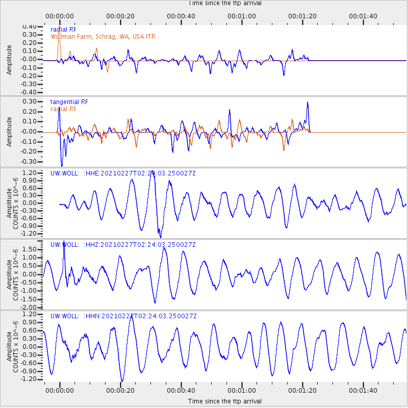
WOLL Wollman Farm, Schrag, WA, USA - Earthquake Result Viewer
*The percent match for this event was below the threshold and hence no stack was calculated.
| Earthquake location: |
Fiji Islands Region |
| Earthquake latitude/longitude: |
-18.5/-177.9 |
| Earthquake time(UTC): |
2021/02/27 (058) 02:13:01 GMT |
| Earthquake Depth: |
554 km |
| Earthquake Magnitude: |
5.6 mww |
| Earthquake Catalog/Contributor: |
NEIC PDE/us |
|
| Network: |
UW Pacific Northwest Regional Seismic Network |
| Station: |
WOLL Wollman Farm, Schrag, WA, USA |
| Lat/Lon: |
47.06 N/118.92 W |
| Elevation: |
385 m |
|
| Distance: |
84.0 deg |
| Az: |
36.112 deg |
| Baz: |
234.882 deg |
| Ray Param: |
$rayparam |
*The percent match for this event was below the threshold and hence was not used in the summary stack. |
|
| Radial Match: |
60.51227 % |
| Radial Bump: |
319 |
| Transverse Match: |
41.469933 % |
| Transverse Bump: |
336 |
| SOD ConfigId: |
23341671 |
| Insert Time: |
2021-03-13 03:33:44.222 +0000 |
| GWidth: |
2.5 |
| Max Bumps: |
400 |
| Tol: |
0.001 |
|
Signal To Noise
| Channel | StoN | STA | LTA |
| UW:WOLL: :HHZ:20210227T02:24:03.250027Z | 1.5883838 | 6.374319E-7 | 4.013085E-7 |
| UW:WOLL: :HHN:20210227T02:24:03.250027Z | 1.651456 | 4.2826645E-7 | 2.5932658E-7 |
| UW:WOLL: :HHE:20210227T02:24:03.250027Z | 2.490889 | 9.254041E-7 | 3.7151557E-7 |
| Arrivals |
| Ps | |
| PpPs | |
| PsPs/PpSs | |


