You are here: Home > Network List > AZ - ANZA Regional Network Stations List
> Station FRD AZ.FRD > Earthquake Result Viewer
FRD AZ.FRD - Earthquake Result Viewer
*The percent match for this event was below the threshold and hence no stack was calculated.
| Earthquake location: |
Near Coast Of Peru |
| Earthquake latitude/longitude: |
-17.6/-72.6 |
| Earthquake time(UTC): |
2021/02/28 (059) 02:16:03 GMT |
| Earthquake Depth: |
9.7 km |
| Earthquake Magnitude: |
5.5 mww |
| Earthquake Catalog/Contributor: |
NEIC PDE/us |
|
| Network: |
AZ ANZA Regional Network |
| Station: |
FRD AZ.FRD |
| Lat/Lon: |
33.49 N/116.60 W |
| Elevation: |
1164 m |
|
| Distance: |
65.9 deg |
| Az: |
320.493 deg |
| Baz: |
133.428 deg |
| Ray Param: |
$rayparam |
*The percent match for this event was below the threshold and hence was not used in the summary stack. |
|
| Radial Match: |
54.171463 % |
| Radial Bump: |
400 |
| Transverse Match: |
80.34325 % |
| Transverse Bump: |
380 |
| SOD ConfigId: |
23341671 |
| Insert Time: |
2021-03-14 03:19:35.255 +0000 |
| GWidth: |
2.5 |
| Max Bumps: |
400 |
| Tol: |
0.001 |
|
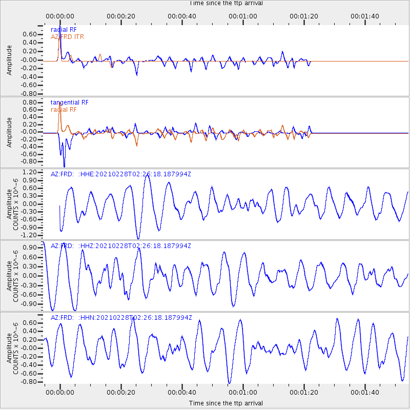
Signal To Noise
| Channel | StoN | STA | LTA |
| AZ:FRD: :HHZ:20210228T02:26:18.187994Z | 1.9506509 | 7.340807E-7 | 3.76326E-7 |
| AZ:FRD: :HHN:20210228T02:26:18.187994Z | 1.2394919 | 4.5052613E-7 | 3.6347643E-7 |
| AZ:FRD: :HHE:20210228T02:26:18.187994Z | 1.4359267 | 6.6285594E-7 | 4.616224E-7 |
| Arrivals |
| Ps | |
| PpPs | |
| PsPs/PpSs | |


