You are here: Home > Network List > CI - Caltech Regional Seismic Network Stations List
> Station MWC Mount Wilson Obsv, Altadena, CA, USA > Earthquake Result Viewer
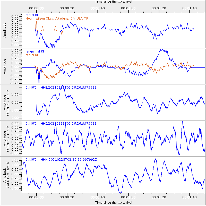
MWC Mount Wilson Obsv, Altadena, CA, USA - Earthquake Result Viewer
*The percent match for this event was below the threshold and hence no stack was calculated.
| Earthquake location: |
Near Coast Of Peru |
| Earthquake latitude/longitude: |
-17.6/-72.6 |
| Earthquake time(UTC): |
2021/02/28 (059) 02:16:03 GMT |
| Earthquake Depth: |
9.7 km |
| Earthquake Magnitude: |
5.5 mww |
| Earthquake Catalog/Contributor: |
NEIC PDE/us |
|
| Network: |
CI Caltech Regional Seismic Network |
| Station: |
MWC Mount Wilson Obsv, Altadena, CA, USA |
| Lat/Lon: |
34.22 N/118.06 W |
| Elevation: |
1725 m |
|
| Distance: |
67.3 deg |
| Az: |
320.173 deg |
| Baz: |
132.493 deg |
| Ray Param: |
$rayparam |
*The percent match for this event was below the threshold and hence was not used in the summary stack. |
|
| Radial Match: |
53.204605 % |
| Radial Bump: |
400 |
| Transverse Match: |
39.418007 % |
| Transverse Bump: |
400 |
| SOD ConfigId: |
23341671 |
| Insert Time: |
2021-03-14 03:21:42.828 +0000 |
| GWidth: |
2.5 |
| Max Bumps: |
400 |
| Tol: |
0.001 |
|
Signal To Noise
| Channel | StoN | STA | LTA |
| CI:MWC: :HHZ:20210228T02:26:26.997992Z | 0.4978871 | 1.8073415E-7 | 3.6300227E-7 |
| CI:MWC: :HHN:20210228T02:26:26.997992Z | 2.902155 | 1.5932667E-6 | 5.4899436E-7 |
| CI:MWC: :HHE:20210228T02:26:26.997992Z | 1.3101557 | 1.3716888E-6 | 1.0469662E-6 |
| Arrivals |
| Ps | |
| PpPs | |
| PsPs/PpSs | |


