You are here: Home > Network List > US - United States National Seismic Network Stations List
> Station HAWA Hanford, Washington, USA > Earthquake Result Viewer
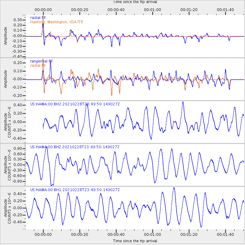
HAWA Hanford, Washington, USA - Earthquake Result Viewer
*The percent match for this event was below the threshold and hence no stack was calculated.
| Earthquake location: |
Vanuatu Islands |
| Earthquake latitude/longitude: |
-17.7/167.5 |
| Earthquake time(UTC): |
2021/02/28 (059) 23:37:15 GMT |
| Earthquake Depth: |
10 km |
| Earthquake Magnitude: |
5.8 mww |
| Earthquake Catalog/Contributor: |
NEIC PDE/us |
|
| Network: |
US United States National Seismic Network |
| Station: |
HAWA Hanford, Washington, USA |
| Lat/Lon: |
46.39 N/119.53 W |
| Elevation: |
364 m |
|
| Distance: |
91.4 deg |
| Az: |
41.456 deg |
| Baz: |
245.744 deg |
| Ray Param: |
$rayparam |
*The percent match for this event was below the threshold and hence was not used in the summary stack. |
|
| Radial Match: |
61.375904 % |
| Radial Bump: |
400 |
| Transverse Match: |
51.324333 % |
| Transverse Bump: |
319 |
| SOD ConfigId: |
23341671 |
| Insert Time: |
2021-03-15 00:48:30.024 +0000 |
| GWidth: |
2.5 |
| Max Bumps: |
400 |
| Tol: |
0.001 |
|
Signal To Noise
| Channel | StoN | STA | LTA |
| US:HAWA:00:BHZ:20210228T23:49:50.149027Z | 4.0094256 | 7.152194E-7 | 1.783845E-7 |
| US:HAWA:00:BH1:20210228T23:49:50.149027Z | 1.1896236 | 1.8885233E-7 | 1.5874964E-7 |
| US:HAWA:00:BH2:20210228T23:49:50.149027Z | 0.97331214 | 1.6149718E-7 | 1.6592537E-7 |
| Arrivals |
| Ps | |
| PpPs | |
| PsPs/PpSs | |


