You are here: Home > Network List > US - United States National Seismic Network Stations List
> Station WMOK Wichita Mountains, Oklahoma, USA > Earthquake Result Viewer
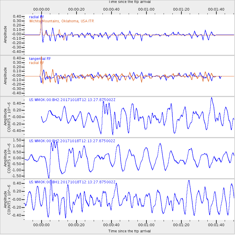
WMOK Wichita Mountains, Oklahoma, USA - Earthquake Result Viewer
*The percent match for this event was below the threshold and hence no stack was calculated.
| Earthquake location: |
Tonga Islands |
| Earthquake latitude/longitude: |
-20.6/-173.9 |
| Earthquake time(UTC): |
2017/10/18 (291) 12:00:59 GMT |
| Earthquake Depth: |
10 km |
| Earthquake Magnitude: |
6.0 Mww |
| Earthquake Catalog/Contributor: |
NEIC PDE/us |
|
| Network: |
US United States National Seismic Network |
| Station: |
WMOK Wichita Mountains, Oklahoma, USA |
| Lat/Lon: |
34.74 N/98.78 W |
| Elevation: |
486 m |
|
| Distance: |
90.0 deg |
| Az: |
52.742 deg |
| Baz: |
244.878 deg |
| Ray Param: |
$rayparam |
*The percent match for this event was below the threshold and hence was not used in the summary stack. |
|
| Radial Match: |
74.57113 % |
| Radial Bump: |
400 |
| Transverse Match: |
51.381058 % |
| Transverse Bump: |
400 |
| SOD ConfigId: |
2364251 |
| Insert Time: |
2017-11-01 12:13:01.585 +0000 |
| GWidth: |
2.5 |
| Max Bumps: |
400 |
| Tol: |
0.001 |
|
Signal To Noise
| Channel | StoN | STA | LTA |
| US:WMOK:00:BHZ:20171018T12:13:27.875002Z | 4.550858 | 7.3310014E-7 | 1.6109053E-7 |
| US:WMOK:00:BH1:20171018T12:13:27.875002Z | 1.6071097 | 2.1866204E-7 | 1.3605919E-7 |
| US:WMOK:00:BH2:20171018T12:13:27.875002Z | 1.8221613 | 2.355596E-7 | 1.2927484E-7 |
| Arrivals |
| Ps | |
| PpPs | |
| PsPs/PpSs | |


