You are here: Home > Network List > CI - Caltech Regional Seismic Network Stations List
> Station LRL Laurel Mtn Radio Fac, Ridgecrest, CA, USA > Earthquake Result Viewer
LRL Laurel Mtn Radio Fac, Ridgecrest, CA, USA - Earthquake Result Viewer
*The percent match for this event was below the threshold and hence no stack was calculated.
| Earthquake location: |
Off Coast Of Ecuador |
| Earthquake latitude/longitude: |
1.0/-85.2 |
| Earthquake time(UTC): |
2021/02/14 (045) 19:46:53 GMT |
| Earthquake Depth: |
31 km |
| Earthquake Magnitude: |
4.6 mb |
| Earthquake Catalog/Contributor: |
NEIC PDE/us |
|
| Network: |
CI Caltech Regional Seismic Network |
| Station: |
LRL Laurel Mtn Radio Fac, Ridgecrest, CA, USA |
| Lat/Lon: |
35.48 N/117.68 W |
| Elevation: |
1340 m |
|
| Distance: |
45.7 deg |
| Az: |
322.234 deg |
| Baz: |
131.386 deg |
| Ray Param: |
$rayparam |
*The percent match for this event was below the threshold and hence was not used in the summary stack. |
|
| Radial Match: |
49.16123 % |
| Radial Bump: |
400 |
| Transverse Match: |
42.6179 % |
| Transverse Bump: |
400 |
| SOD ConfigId: |
23341671 |
| Insert Time: |
2021-03-15 13:50:54.453 +0000 |
| GWidth: |
2.5 |
| Max Bumps: |
400 |
| Tol: |
0.001 |
|
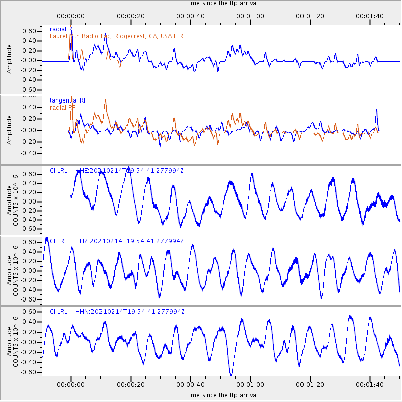
Signal To Noise
| Channel | StoN | STA | LTA |
| CI:LRL: :HHZ:20210214T19:54:41.277994Z | 1.0393249 | 3.1031834E-7 | 2.9857685E-7 |
| CI:LRL: :HHN:20210214T19:54:41.277994Z | 1.4800928 | 4.0483712E-7 | 2.7352144E-7 |
| CI:LRL: :HHE:20210214T19:54:41.277994Z | 1.4467224 | 4.6837093E-7 | 3.2374626E-7 |
| Arrivals |
| Ps | |
| PpPs | |
| PsPs/PpSs | |


