You are here: Home > Network List > CI - Caltech Regional Seismic Network Stations List
> Station MPM Manuel Prospect Mine, California, USA > Earthquake Result Viewer
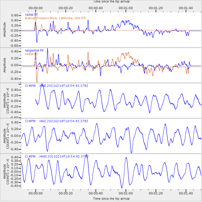
MPM Manuel Prospect Mine, California, USA - Earthquake Result Viewer
*The percent match for this event was below the threshold and hence no stack was calculated.
| Earthquake location: |
Off Coast Of Ecuador |
| Earthquake latitude/longitude: |
1.0/-85.2 |
| Earthquake time(UTC): |
2021/02/14 (045) 19:46:53 GMT |
| Earthquake Depth: |
31 km |
| Earthquake Magnitude: |
4.6 mb |
| Earthquake Catalog/Contributor: |
NEIC PDE/us |
|
| Network: |
CI Caltech Regional Seismic Network |
| Station: |
MPM Manuel Prospect Mine, California, USA |
| Lat/Lon: |
36.06 N/117.49 W |
| Elevation: |
185 m |
|
| Distance: |
45.9 deg |
| Az: |
322.981 deg |
| Baz: |
132.019 deg |
| Ray Param: |
$rayparam |
*The percent match for this event was below the threshold and hence was not used in the summary stack. |
|
| Radial Match: |
53.629574 % |
| Radial Bump: |
400 |
| Transverse Match: |
60.83345 % |
| Transverse Bump: |
350 |
| SOD ConfigId: |
23341671 |
| Insert Time: |
2021-03-15 13:50:58.568 +0000 |
| GWidth: |
2.5 |
| Max Bumps: |
400 |
| Tol: |
0.001 |
|
Signal To Noise
| Channel | StoN | STA | LTA |
| CI:MPM: :HHZ:20210214T19:54:43.378Z | 0.43372986 | 9.6578994E-8 | 2.2267085E-7 |
| CI:MPM: :HHN:20210214T19:54:43.378Z | 1.1745163 | 2.3271117E-7 | 1.9813362E-7 |
| CI:MPM: :HHE:20210214T19:54:43.378Z | 1.0253943 | 2.5563057E-7 | 2.4929977E-7 |
| Arrivals |
| Ps | |
| PpPs | |
| PsPs/PpSs | |


