You are here: Home > Network List > TA - USArray Transportable Network (new EarthScope stations) Stations List
> Station E20K Nigu River, AK, USA > Earthquake Result Viewer
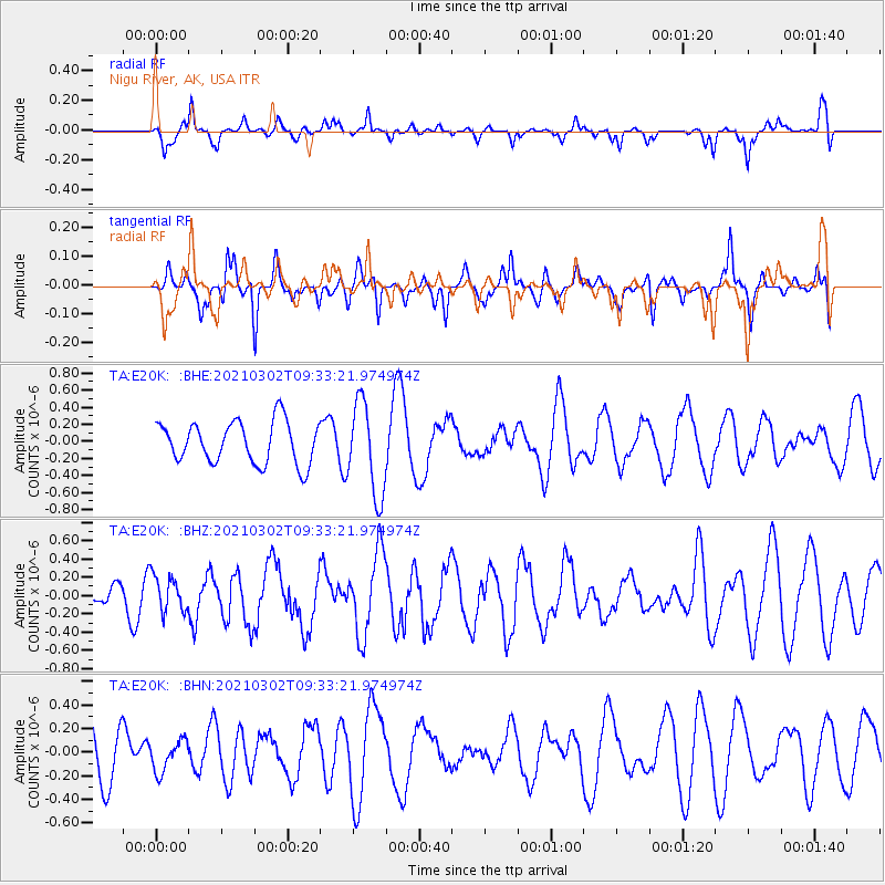
E20K Nigu River, AK, USA - Earthquake Result Viewer
*The percent match for this event was below the threshold and hence no stack was calculated.
| Earthquake location: |
Taiwan Region |
| Earthquake latitude/longitude: |
21.9/121.2 |
| Earthquake time(UTC): |
2021/03/02 (061) 09:23:02 GMT |
| Earthquake Depth: |
30 km |
| Earthquake Magnitude: |
5.5 mww |
| Earthquake Catalog/Contributor: |
NEIC PDE/us |
|
| Network: |
TA USArray Transportable Network (new EarthScope stations) |
| Station: |
E20K Nigu River, AK, USA |
| Lat/Lon: |
68.26 N/156.19 W |
| Elevation: |
866 m |
|
| Distance: |
67.1 deg |
| Az: |
23.647 deg |
| Baz: |
271.723 deg |
| Ray Param: |
$rayparam |
*The percent match for this event was below the threshold and hence was not used in the summary stack. |
|
| Radial Match: |
33.32992 % |
| Radial Bump: |
238 |
| Transverse Match: |
40.689995 % |
| Transverse Bump: |
271 |
| SOD ConfigId: |
23341671 |
| Insert Time: |
2021-03-16 10:34:11.508 +0000 |
| GWidth: |
2.5 |
| Max Bumps: |
400 |
| Tol: |
0.001 |
|
Signal To Noise
| Channel | StoN | STA | LTA |
| TA:E20K: :BHZ:20210302T09:33:21.974974Z | 1.3674184 | 1.9726046E-7 | 1.4425757E-7 |
| TA:E20K: :BHN:20210302T09:33:21.974974Z | 0.596414 | 1.3255092E-7 | 2.222465E-7 |
| TA:E20K: :BHE:20210302T09:33:21.974974Z | 2.2212133 | 5.42165E-7 | 2.4408507E-7 |
| Arrivals |
| Ps | |
| PpPs | |
| PsPs/PpSs | |


