You are here: Home > Network List > US - United States National Seismic Network Stations List
> Station MSO Missoula, Montana, USA > Earthquake Result Viewer
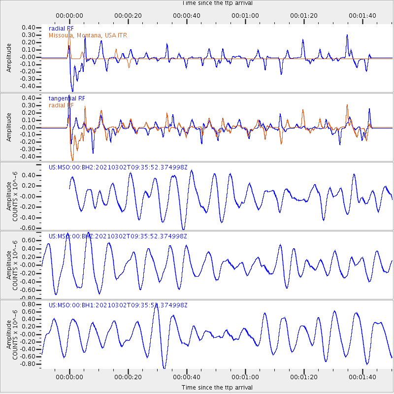
MSO Missoula, Montana, USA - Earthquake Result Viewer
*The percent match for this event was below the threshold and hence no stack was calculated.
| Earthquake location: |
Taiwan Region |
| Earthquake latitude/longitude: |
21.9/121.2 |
| Earthquake time(UTC): |
2021/03/02 (061) 09:23:02 GMT |
| Earthquake Depth: |
30 km |
| Earthquake Magnitude: |
5.5 mww |
| Earthquake Catalog/Contributor: |
NEIC PDE/us |
|
| Network: |
US United States National Seismic Network |
| Station: |
MSO Missoula, Montana, USA |
| Lat/Lon: |
46.83 N/113.94 W |
| Elevation: |
1264 m |
|
| Distance: |
95.4 deg |
| Az: |
34.463 deg |
| Baz: |
310.074 deg |
| Ray Param: |
$rayparam |
*The percent match for this event was below the threshold and hence was not used in the summary stack. |
|
| Radial Match: |
70.95373 % |
| Radial Bump: |
400 |
| Transverse Match: |
70.95195 % |
| Transverse Bump: |
400 |
| SOD ConfigId: |
23341671 |
| Insert Time: |
2021-03-16 10:35:22.413 +0000 |
| GWidth: |
2.5 |
| Max Bumps: |
400 |
| Tol: |
0.001 |
|
Signal To Noise
| Channel | StoN | STA | LTA |
| US:MSO:00:BHZ:20210302T09:35:52.374998Z | 1.8102977 | 4.8588447E-7 | 2.684003E-7 |
| US:MSO:00:BH1:20210302T09:35:52.374998Z | 1.1240073 | 3.0705573E-7 | 2.7317947E-7 |
| US:MSO:00:BH2:20210302T09:35:52.374998Z | 1.4518561 | 3.0950608E-7 | 2.1317959E-7 |
| Arrivals |
| Ps | |
| PpPs | |
| PsPs/PpSs | |


