You are here: Home > Network List > CI - Caltech Regional Seismic Network Stations List
> Station BAR Barrett, Tecate, CA, USA > Earthquake Result Viewer
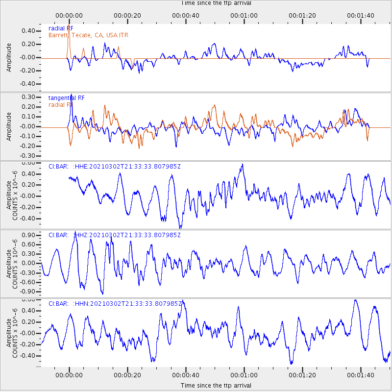
BAR Barrett, Tecate, CA, USA - Earthquake Result Viewer
*The percent match for this event was below the threshold and hence no stack was calculated.
| Earthquake location: |
Kuril Islands |
| Earthquake latitude/longitude: |
44.0/147.9 |
| Earthquake time(UTC): |
2021/03/02 (061) 21:22:45 GMT |
| Earthquake Depth: |
28 km |
| Earthquake Magnitude: |
5.8 mww |
| Earthquake Catalog/Contributor: |
NEIC PDE/us |
|
| Network: |
CI Caltech Regional Seismic Network |
| Station: |
BAR Barrett, Tecate, CA, USA |
| Lat/Lon: |
32.68 N/116.67 W |
| Elevation: |
521 m |
|
| Distance: |
71.7 deg |
| Az: |
62.149 deg |
| Baz: |
310.791 deg |
| Ray Param: |
$rayparam |
*The percent match for this event was below the threshold and hence was not used in the summary stack. |
|
| Radial Match: |
36.721134 % |
| Radial Bump: |
400 |
| Transverse Match: |
51.634007 % |
| Transverse Bump: |
400 |
| SOD ConfigId: |
23341671 |
| Insert Time: |
2021-03-16 22:30:55.984 +0000 |
| GWidth: |
2.5 |
| Max Bumps: |
400 |
| Tol: |
0.001 |
|
Signal To Noise
| Channel | StoN | STA | LTA |
| CI:BAR: :HHZ:20210302T21:33:33.807985Z | 3.380031 | 5.9355085E-7 | 1.7560514E-7 |
| CI:BAR: :HHN:20210302T21:33:33.807985Z | 1.6407921 | 2.1612148E-7 | 1.3171777E-7 |
| CI:BAR: :HHE:20210302T21:33:33.807985Z | 1.8102827 | 3.1396664E-7 | 1.7343514E-7 |
| Arrivals |
| Ps | |
| PpPs | |
| PsPs/PpSs | |


