You are here: Home > Network List > TA - USArray Transportable Network (new EarthScope stations) Stations List
> Station D23K Nanushuk River, AK USA > Earthquake Result Viewer
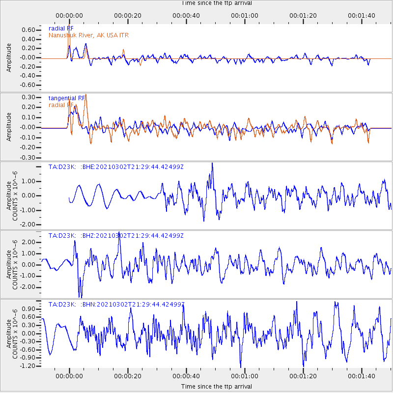
D23K Nanushuk River, AK USA - Earthquake Result Viewer
*The percent match for this event was below the threshold and hence no stack was calculated.
| Earthquake location: |
Kuril Islands |
| Earthquake latitude/longitude: |
44.0/147.9 |
| Earthquake time(UTC): |
2021/03/02 (061) 21:22:45 GMT |
| Earthquake Depth: |
28 km |
| Earthquake Magnitude: |
5.8 mww |
| Earthquake Catalog/Contributor: |
NEIC PDE/us |
|
| Network: |
TA USArray Transportable Network (new EarthScope stations) |
| Station: |
D23K Nanushuk River, AK USA |
| Lat/Lon: |
68.97 N/150.68 W |
| Elevation: |
406 m |
|
| Distance: |
39.7 deg |
| Az: |
29.785 deg |
| Baz: |
263.517 deg |
| Ray Param: |
$rayparam |
*The percent match for this event was below the threshold and hence was not used in the summary stack. |
|
| Radial Match: |
54.00882 % |
| Radial Bump: |
400 |
| Transverse Match: |
58.83435 % |
| Transverse Bump: |
400 |
| SOD ConfigId: |
23341671 |
| Insert Time: |
2021-03-16 22:45:08.352 +0000 |
| GWidth: |
2.5 |
| Max Bumps: |
400 |
| Tol: |
0.001 |
|
Signal To Noise
| Channel | StoN | STA | LTA |
| TA:D23K: :BHZ:20210302T21:29:44.42499Z | 3.103381 | 1.3583416E-6 | 4.3769737E-7 |
| TA:D23K: :BHN:20210302T21:29:44.42499Z | 1.3914158 | 3.8172473E-7 | 2.7434265E-7 |
| TA:D23K: :BHE:20210302T21:29:44.42499Z | 0.9582145 | 4.0675621E-7 | 4.244939E-7 |
| Arrivals |
| Ps | |
| PpPs | |
| PsPs/PpSs | |


