You are here: Home > Network List > IU - Global Seismograph Network (GSN - IRIS/USGS) Stations List
> Station PMG Port Moresby, New Guinea > Earthquake Result Viewer
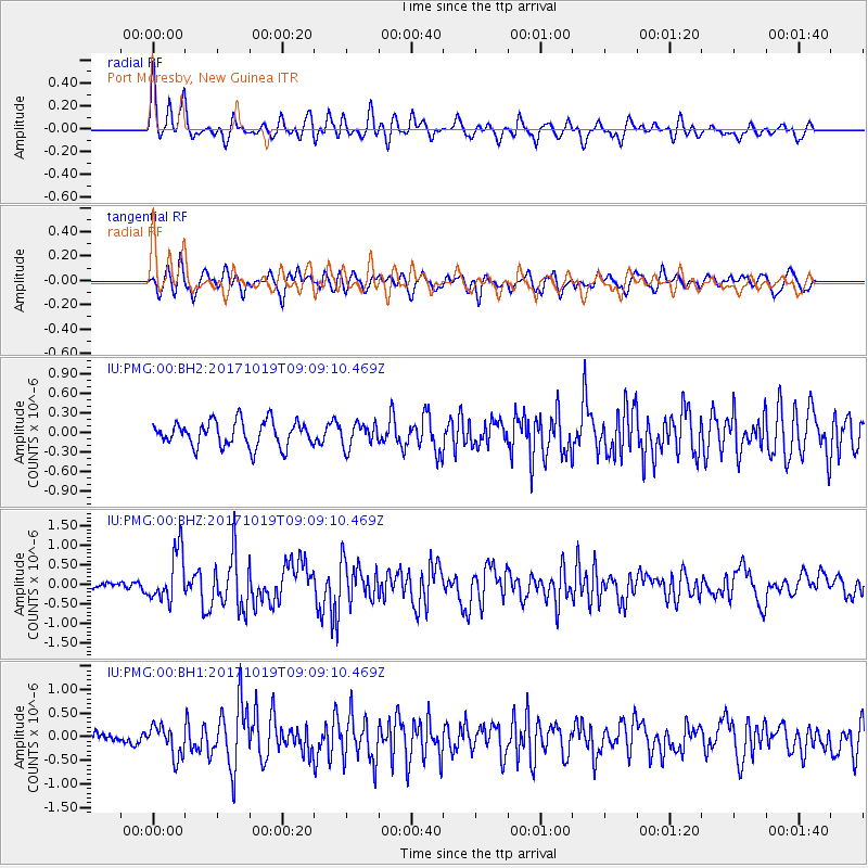
PMG Port Moresby, New Guinea - Earthquake Result Viewer
*The percent match for this event was below the threshold and hence no stack was calculated.
| Earthquake location: |
Southeast Of Ryukyu Islands |
| Earthquake latitude/longitude: |
28.3/131.2 |
| Earthquake time(UTC): |
2017/10/19 (292) 09:02:01 GMT |
| Earthquake Depth: |
10 km |
| Earthquake Magnitude: |
5.8 Mww |
| Earthquake Catalog/Contributor: |
NEIC PDE/us |
|
| Network: |
IU Global Seismograph Network (GSN - IRIS/USGS) |
| Station: |
PMG Port Moresby, New Guinea |
| Lat/Lon: |
9.40 S/147.16 E |
| Elevation: |
90 m |
|
| Distance: |
40.6 deg |
| Az: |
155.338 deg |
| Baz: |
338.111 deg |
| Ray Param: |
$rayparam |
*The percent match for this event was below the threshold and hence was not used in the summary stack. |
|
| Radial Match: |
72.15116 % |
| Radial Bump: |
400 |
| Transverse Match: |
65.66466 % |
| Transverse Bump: |
400 |
| SOD ConfigId: |
2364251 |
| Insert Time: |
2017-11-02 09:05:12.105 +0000 |
| GWidth: |
2.5 |
| Max Bumps: |
400 |
| Tol: |
0.001 |
|
Signal To Noise
| Channel | StoN | STA | LTA |
| IU:PMG:00:BHZ:20171019T09:09:10.469Z | 5.6925325 | 6.3970646E-7 | 1.12376426E-7 |
| IU:PMG:00:BH1:20171019T09:09:10.469Z | 2.873337 | 3.2145604E-7 | 1.1187551E-7 |
| IU:PMG:00:BH2:20171019T09:09:10.469Z | 0.94800854 | 1.814612E-7 | 1.9141305E-7 |
| Arrivals |
| Ps | |
| PpPs | |
| PsPs/PpSs | |


