You are here: Home > Network List > IW - Intermountain West Stations List
> Station IMW Indian Meadow, Wyoming, USA > Earthquake Result Viewer
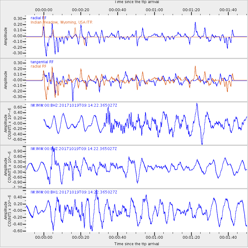
IMW Indian Meadow, Wyoming, USA - Earthquake Result Viewer
*The percent match for this event was below the threshold and hence no stack was calculated.
| Earthquake location: |
Southeast Of Ryukyu Islands |
| Earthquake latitude/longitude: |
28.3/131.2 |
| Earthquake time(UTC): |
2017/10/19 (292) 09:02:01 GMT |
| Earthquake Depth: |
10 km |
| Earthquake Magnitude: |
5.8 Mww |
| Earthquake Catalog/Contributor: |
NEIC PDE/us |
|
| Network: |
IW Intermountain West |
| Station: |
IMW Indian Meadow, Wyoming, USA |
| Lat/Lon: |
43.90 N/110.94 W |
| Elevation: |
2646 m |
|
| Distance: |
88.4 deg |
| Az: |
39.746 deg |
| Baz: |
308.761 deg |
| Ray Param: |
$rayparam |
*The percent match for this event was below the threshold and hence was not used in the summary stack. |
|
| Radial Match: |
72.837845 % |
| Radial Bump: |
400 |
| Transverse Match: |
51.809883 % |
| Transverse Bump: |
400 |
| SOD ConfigId: |
2364251 |
| Insert Time: |
2017-11-02 09:05:36.262 +0000 |
| GWidth: |
2.5 |
| Max Bumps: |
400 |
| Tol: |
0.001 |
|
Signal To Noise
| Channel | StoN | STA | LTA |
| IW:IMW:00:BHZ:20171019T09:14:22.365027Z | 3.5146716 | 5.032248E-7 | 1.4317833E-7 |
| IW:IMW:00:BH1:20171019T09:14:22.365027Z | 1.304894 | 1.9409661E-7 | 1.4874512E-7 |
| IW:IMW:00:BH2:20171019T09:14:22.365027Z | 1.3137045 | 2.3296558E-7 | 1.7733484E-7 |
| Arrivals |
| Ps | |
| PpPs | |
| PsPs/PpSs | |


