You are here: Home > Network List > US - United States National Seismic Network Stations List
> Station DGMT Dagmar, Montana, USA > Earthquake Result Viewer
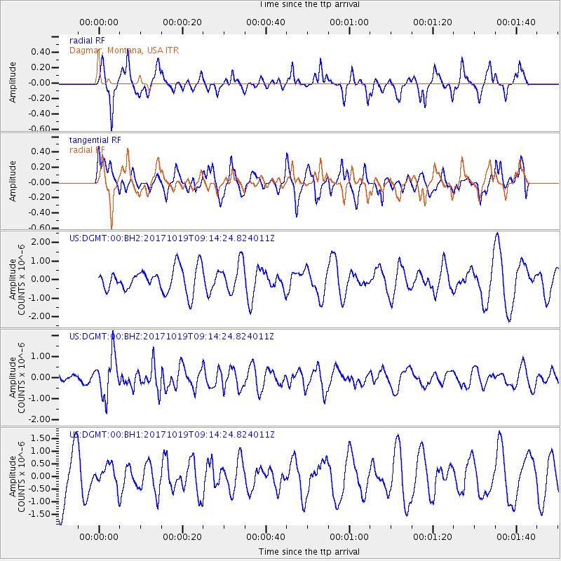
DGMT Dagmar, Montana, USA - Earthquake Result Viewer
*The percent match for this event was below the threshold and hence no stack was calculated.
| Earthquake location: |
Southeast Of Ryukyu Islands |
| Earthquake latitude/longitude: |
28.3/131.2 |
| Earthquake time(UTC): |
2017/10/19 (292) 09:02:01 GMT |
| Earthquake Depth: |
10 km |
| Earthquake Magnitude: |
5.8 Mww |
| Earthquake Catalog/Contributor: |
NEIC PDE/us |
|
| Network: |
US United States National Seismic Network |
| Station: |
DGMT Dagmar, Montana, USA |
| Lat/Lon: |
48.47 N/104.20 W |
| Elevation: |
0.0 m |
|
| Distance: |
88.9 deg |
| Az: |
33.222 deg |
| Baz: |
313.464 deg |
| Ray Param: |
$rayparam |
*The percent match for this event was below the threshold and hence was not used in the summary stack. |
|
| Radial Match: |
49.61855 % |
| Radial Bump: |
283 |
| Transverse Match: |
36.793877 % |
| Transverse Bump: |
400 |
| SOD ConfigId: |
2364251 |
| Insert Time: |
2017-11-02 09:07:07.932 +0000 |
| GWidth: |
2.5 |
| Max Bumps: |
400 |
| Tol: |
0.001 |
|
Signal To Noise
| Channel | StoN | STA | LTA |
| US:DGMT:00:BHZ:20171019T09:14:24.824011Z | 2.235113 | 9.532666E-7 | 4.2649592E-7 |
| US:DGMT:00:BH1:20171019T09:14:24.824011Z | 0.42745444 | 4.340505E-7 | 1.015431E-6 |
| US:DGMT:00:BH2:20171019T09:14:24.824011Z | 1.2734404 | 8.0682554E-7 | 6.335794E-7 |
| Arrivals |
| Ps | |
| PpPs | |
| PsPs/PpSs | |


