You are here: Home > Network List > US - United States National Seismic Network Stations List
> Station MSO Missoula, Montana, USA > Earthquake Result Viewer
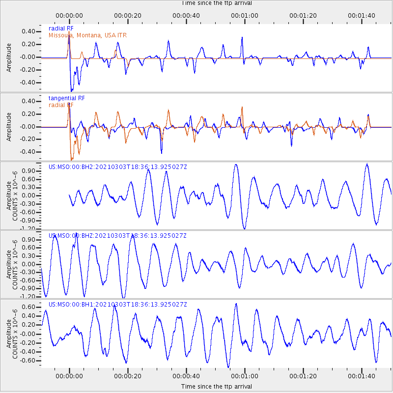
MSO Missoula, Montana, USA - Earthquake Result Viewer
*The percent match for this event was below the threshold and hence no stack was calculated.
| Earthquake location: |
Greece |
| Earthquake latitude/longitude: |
39.7/22.1 |
| Earthquake time(UTC): |
2021/03/03 (062) 18:24:08 GMT |
| Earthquake Depth: |
10 km |
| Earthquake Magnitude: |
5.1 Mww |
| Earthquake Catalog/Contributor: |
NEIC PDE/us |
|
| Network: |
US United States National Seismic Network |
| Station: |
MSO Missoula, Montana, USA |
| Lat/Lon: |
46.83 N/113.94 W |
| Elevation: |
1264 m |
|
| Distance: |
85.3 deg |
| Az: |
331.435 deg |
| Baz: |
32.483 deg |
| Ray Param: |
$rayparam |
*The percent match for this event was below the threshold and hence was not used in the summary stack. |
|
| Radial Match: |
69.18768 % |
| Radial Bump: |
400 |
| Transverse Match: |
55.954662 % |
| Transverse Bump: |
400 |
| SOD ConfigId: |
23341671 |
| Insert Time: |
2021-03-17 19:43:30.981 +0000 |
| GWidth: |
2.5 |
| Max Bumps: |
400 |
| Tol: |
0.001 |
|
Signal To Noise
| Channel | StoN | STA | LTA |
| US:MSO:00:BHZ:20210303T18:36:13.925027Z | 1.2283491 | 7.1031656E-7 | 5.782693E-7 |
| US:MSO:00:BH1:20210303T18:36:13.925027Z | 0.22090733 | 1.0887135E-7 | 4.928372E-7 |
| US:MSO:00:BH2:20210303T18:36:13.925027Z | 2.4287515 | 6.4876826E-7 | 2.6712007E-7 |
| Arrivals |
| Ps | |
| PpPs | |
| PsPs/PpSs | |


