You are here: Home > Network List > IU - Global Seismograph Network (GSN - IRIS/USGS) Stations List
> Station JOHN Johnston Island, USA > Earthquake Result Viewer
JOHN Johnston Island, USA - Earthquake Result Viewer
*The percent match for this event was below the threshold and hence no stack was calculated.
| Earthquake location: |
Off E. Coast Of N. Island, N.Z. |
| Earthquake latitude/longitude: |
-37.6/179.5 |
| Earthquake time(UTC): |
2021/03/04 (063) 13:27:35 GMT |
| Earthquake Depth: |
10 km |
| Earthquake Magnitude: |
6.9 mww |
| Earthquake Catalog/Contributor: |
NEIC PDE/us |
|
| Network: |
IU Global Seismograph Network (GSN - IRIS/USGS) |
| Station: |
JOHN Johnston Island, USA |
| Lat/Lon: |
16.73 N/169.53 W |
| Elevation: |
2.0 m |
|
| Distance: |
55.0 deg |
| Az: |
12.81 deg |
| Baz: |
190.591 deg |
| Ray Param: |
$rayparam |
*The percent match for this event was below the threshold and hence was not used in the summary stack. |
|
| Radial Match: |
82.53334 % |
| Radial Bump: |
400 |
| Transverse Match: |
73.68973 % |
| Transverse Bump: |
400 |
| SOD ConfigId: |
23341671 |
| Insert Time: |
2021-03-18 14:36:21.154 +0000 |
| GWidth: |
2.5 |
| Max Bumps: |
400 |
| Tol: |
0.001 |
|
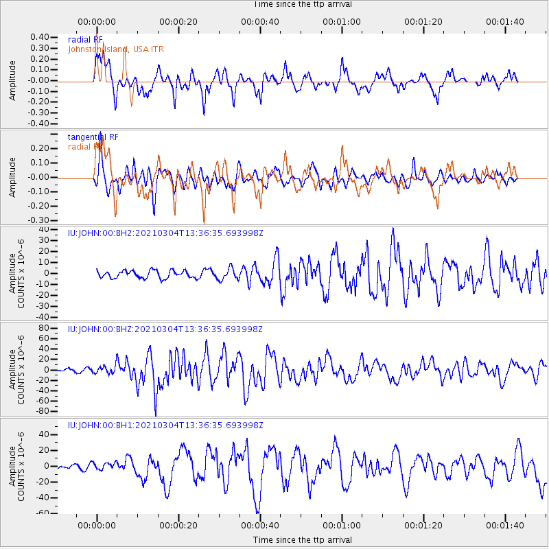
Signal To Noise
| Channel | StoN | STA | LTA |
| IU:JOHN:00:BHZ:20210304T13:36:35.693998Z | 2.1883862 | 8.360792E-6 | 3.8205285E-6 |
| IU:JOHN:00:BH1:20210304T13:36:35.693998Z | 1.2617456 | 4.228644E-6 | 3.3514236E-6 |
| IU:JOHN:00:BH2:20210304T13:36:35.693998Z | 1.5776666 | 5.324604E-6 | 3.3749868E-6 |
| Arrivals |
| Ps | |
| PpPs | |
| PsPs/PpSs | |


