You are here: Home > Network List > II - Global Seismograph Network (GSN - IRIS/IDA) Stations List
> Station WRAB Tennant Creek, NT, Australia > Earthquake Result Viewer
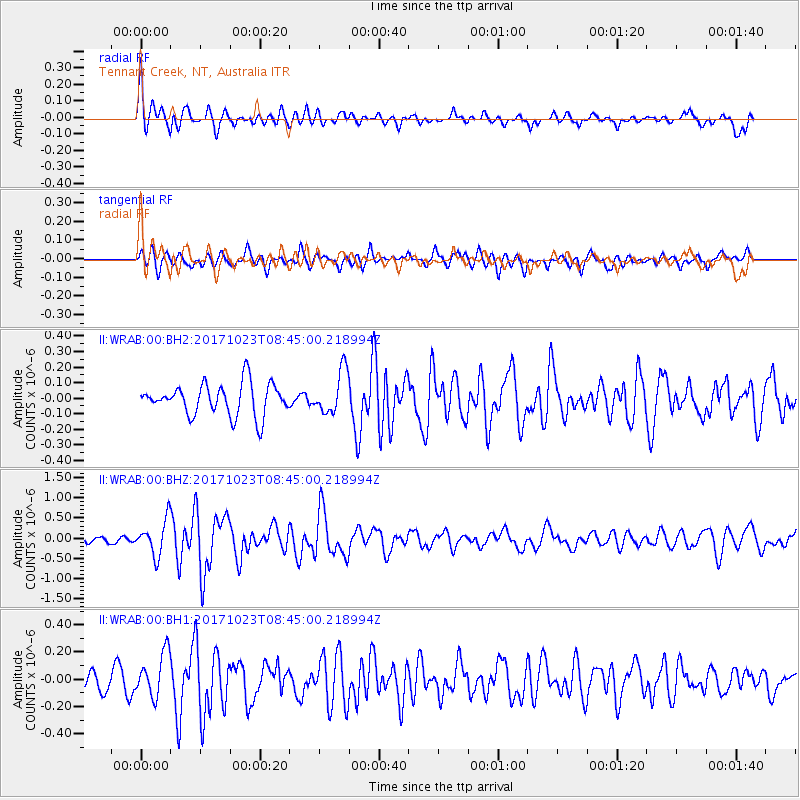
WRAB Tennant Creek, NT, Australia - Earthquake Result Viewer
*The percent match for this event was below the threshold and hence no stack was calculated.
| Earthquake location: |
Southwest Of Africa |
| Earthquake latitude/longitude: |
-52.4/16.7 |
| Earthquake time(UTC): |
2017/10/23 (296) 08:32:32 GMT |
| Earthquake Depth: |
10 km |
| Earthquake Magnitude: |
6.0 Mww |
| Earthquake Catalog/Contributor: |
NEIC PDE/us |
|
| Network: |
II Global Seismograph Network (GSN - IRIS/IDA) |
| Station: |
WRAB Tennant Creek, NT, Australia |
| Lat/Lon: |
19.93 S/134.36 E |
| Elevation: |
366 m |
|
| Distance: |
90.0 deg |
| Az: |
123.525 deg |
| Baz: |
212.924 deg |
| Ray Param: |
$rayparam |
*The percent match for this event was below the threshold and hence was not used in the summary stack. |
|
| Radial Match: |
69.10589 % |
| Radial Bump: |
400 |
| Transverse Match: |
51.61541 % |
| Transverse Bump: |
400 |
| SOD ConfigId: |
2364251 |
| Insert Time: |
2017-11-06 08:34:47.387 +0000 |
| GWidth: |
2.5 |
| Max Bumps: |
400 |
| Tol: |
0.001 |
|
Signal To Noise
| Channel | StoN | STA | LTA |
| II:WRAB:00:BHZ:20171023T08:45:00.218994Z | 2.729718 | 4.3007603E-7 | 1.5755329E-7 |
| II:WRAB:00:BH1:20171023T08:45:00.218994Z | 1.6725495 | 1.6175399E-7 | 9.6711034E-8 |
| II:WRAB:00:BH2:20171023T08:45:00.218994Z | 1.3613893 | 1.3813714E-7 | 1.0146777E-7 |
| Arrivals |
| Ps | |
| PpPs | |
| PsPs/PpSs | |


