You are here: Home > Network List > IU - Global Seismograph Network (GSN - IRIS/USGS) Stations List
> Station XMAS Kiritimati Island, Republic of Kiribati > Earthquake Result Viewer
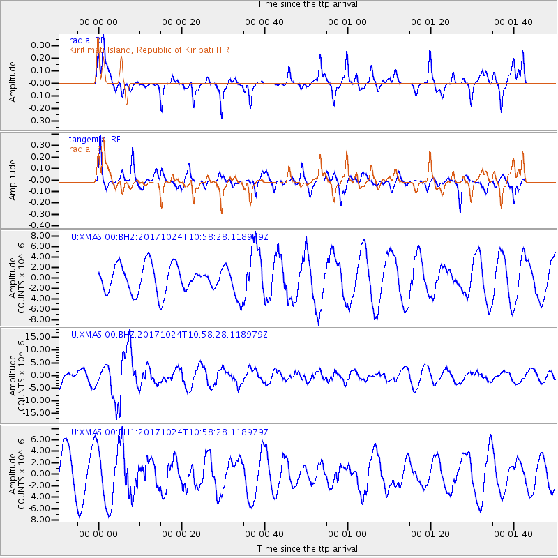
XMAS Kiritimati Island, Republic of Kiribati - Earthquake Result Viewer
*The percent match for this event was below the threshold and hence no stack was calculated.
| Earthquake location: |
Banda Sea |
| Earthquake latitude/longitude: |
-7.2/123.0 |
| Earthquake time(UTC): |
2017/10/24 (297) 10:47:47 GMT |
| Earthquake Depth: |
549 km |
| Earthquake Magnitude: |
6.7 Mww |
| Earthquake Catalog/Contributor: |
NEIC PDE/us |
|
| Network: |
IU Global Seismograph Network (GSN - IRIS/USGS) |
| Station: |
XMAS Kiritimati Island, Republic of Kiribati |
| Lat/Lon: |
2.04 N/157.45 W |
| Elevation: |
20 m |
|
| Distance: |
79.9 deg |
| Az: |
86.627 deg |
| Baz: |
262.326 deg |
| Ray Param: |
$rayparam |
*The percent match for this event was below the threshold and hence was not used in the summary stack. |
|
| Radial Match: |
72.283424 % |
| Radial Bump: |
400 |
| Transverse Match: |
72.62475 % |
| Transverse Bump: |
339 |
| SOD ConfigId: |
2364251 |
| Insert Time: |
2017-11-07 10:50:03.173 +0000 |
| GWidth: |
2.5 |
| Max Bumps: |
400 |
| Tol: |
0.001 |
|
Signal To Noise
| Channel | StoN | STA | LTA |
| IU:XMAS:00:BHZ:20171024T10:58:28.118979Z | 1.7258909 | 6.772991E-6 | 3.924345E-6 |
| IU:XMAS:00:BH1:20171024T10:58:28.118979Z | 1.8516195 | 5.076643E-6 | 2.7417311E-6 |
| IU:XMAS:00:BH2:20171024T10:58:28.118979Z | 1.1482313 | 3.1184811E-6 | 2.7158999E-6 |
| Arrivals |
| Ps | |
| PpPs | |
| PsPs/PpSs | |


