You are here: Home > Network List > CI - Caltech Regional Seismic Network Stations List
> Station DAN Danby, California, USA > Earthquake Result Viewer
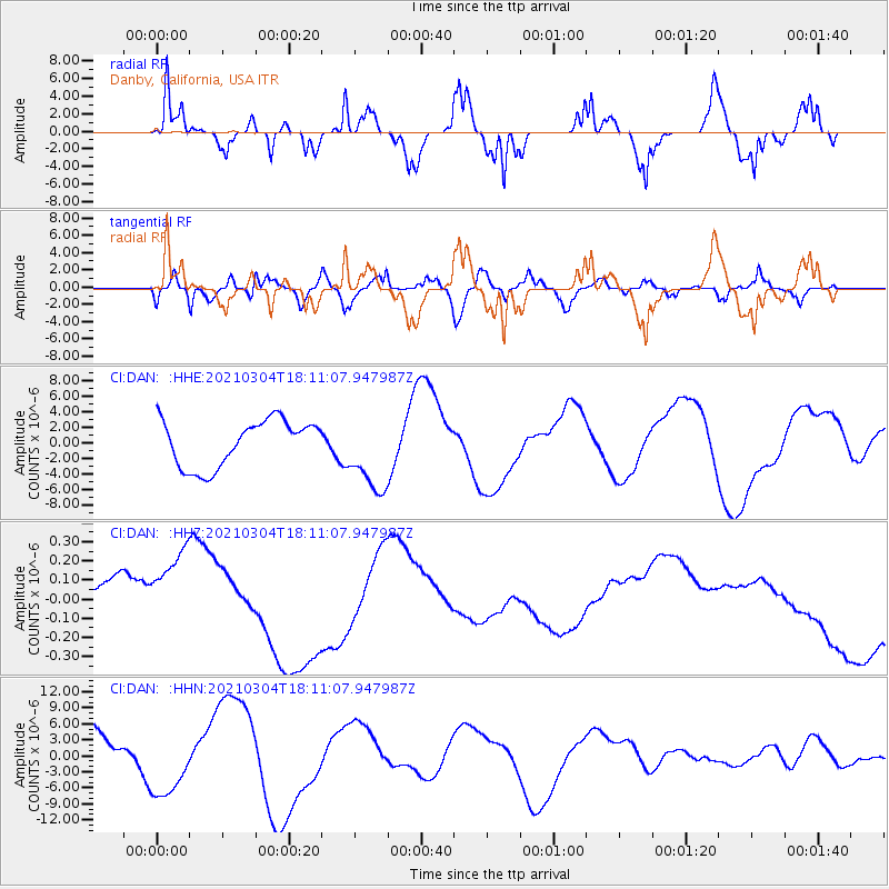
DAN Danby, California, USA - Earthquake Result Viewer
*The percent match for this event was below the threshold and hence no stack was calculated.
| Earthquake location: |
Kermadec Islands Region |
| Earthquake latitude/longitude: |
-29.8/-175.7 |
| Earthquake time(UTC): |
2021/03/04 (063) 17:59:00 GMT |
| Earthquake Depth: |
10 km |
| Earthquake Magnitude: |
5.5 mb |
| Earthquake Catalog/Contributor: |
NEIC PDE/us |
|
| Network: |
CI Caltech Regional Seismic Network |
| Station: |
DAN Danby, California, USA |
| Lat/Lon: |
34.64 N/115.38 W |
| Elevation: |
398 m |
|
| Distance: |
85.7 deg |
| Az: |
45.936 deg |
| Baz: |
229.241 deg |
| Ray Param: |
$rayparam |
*The percent match for this event was below the threshold and hence was not used in the summary stack. |
|
| Radial Match: |
42.769436 % |
| Radial Bump: |
241 |
| Transverse Match: |
42.9712 % |
| Transverse Bump: |
362 |
| SOD ConfigId: |
23341671 |
| Insert Time: |
2021-03-18 19:07:24.357 +0000 |
| GWidth: |
2.5 |
| Max Bumps: |
400 |
| Tol: |
0.001 |
|
Signal To Noise
| Channel | StoN | STA | LTA |
| CI:DAN: :HHZ:20210304T18:11:07.947987Z | 1.3815943 | 3.7364416E-7 | 2.7044422E-7 |
| CI:DAN: :HHN:20210304T18:11:07.947987Z | 1.2128626 | 6.1668843E-6 | 5.0845697E-6 |
| CI:DAN: :HHE:20210304T18:11:07.947987Z | 1.6913242 | 5.0417593E-6 | 2.9809537E-6 |
| Arrivals |
| Ps | |
| PpPs | |
| PsPs/PpSs | |


